Kaimur district
Kaimur district | |
|---|---|
 Telhar Falls | |
 | |
| Country | India |
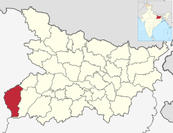
| State | Bihar |
| Administrative Division | Patna Division |
| Headquarters | Bhabua |
| Area | |
| • Total | 3,362 km2 (1,298 sq mi) |
| Population (2011) | |
| • Total | 1,626,384 |
| Time zone | UTC+5:30 (IST) |
| ISO 3166 code | IN-BR |
| Lok Sabha | Sasaram |
| Website | http://www.kaimur.bih.nic.in/ |
Kaimur district is one of the 38 districts of Bihar. The district headquarters are at Bhabua. Before 1991, it was part of Rohtas District. Till 1764 the region (Kaimur district) was a part of Ghazipur District and was a part of and later it was a part of till 1837.
The district occupies an area of 3363 km² and has a population of 1,626,384 (as of 2011) with the rank of 307th in the country. The district has a Literacy rate of 69.34% (392nd in the country). Kaimur district is a part of Patna division. It is the Western-southern district of Bihar, Western-southern point of Bihar called Chand is situated on the Bhabua–Chandauli road. The district has 18 colleges, 58 high schools, 146 middle schools, and 763 primary schools. The district has a total of 1699 villages. The district also has 120 post offices and 151 panchayat, and is well connected with NH-2(Grand trunk road). Which is accomplished by Bhabhua Road (BBU) railway station it is the main route which connects Sealdah to Mumbai via Gaya junction.
The most spoken languages are Hindi and Bhojpuri mainly. Due to its close proximity to eastern Uttar Pradesh, people here have Purvanchali tinge in their language.
History[]
| Year | Pop. | ±% p.a. |
|---|---|---|
| 1901 | 317,384 | — |
| 1911 | 301,646 | −0.51% |
| 1921 | 293,753 | −0.26% |
| 1931 | 322,778 | +0.95% |
| 1941 | 377,028 | +1.57% |
| 1951 | 435,283 | +1.45% |
| 1961 | 526,251 | +1.92% |
| 1971 | 656,905 | +2.24% |
| 1981 | 783,045 | +1.77% |
| 1991 | 972,949 | +2.20% |
| 2001 | 1,275,579 | +2.75% |
| 2011 | 1,626,384 | +2.46% |
| source:[1] | ||
Kaimur district was established on 17 March 1991 when it was split off from Rohtas district. It was called Bhabua district until 1994, when it was renamed to its current name.[2]
The earliest evidence of human habitation in the district consists of rock paintings in the Lehda forest that date to around 20,000 years ago. In June 2012, erotic Pala sculptures were excavated in the village of Baidyanath.[3]
It is currently a part of the Red Corridor.[4] In the other side it is associated with belief of Hindus it is Penitential of Atri (Sanskrit: अत्रि) or Attri Rishi & one of the oldest temple in India of Ma Mundeswari which is the part of attraction of tourism.
Geography[]
Kaimur district occupies an area of 3,362 square kilometres (1,298 sq mi),[5] comparatively equivalent to Russia's Vaygach Island.[6] Geographically, the district can be divided into two parts viz. (i) Hilly area and (ii) Plain area. The hilly area is Kaimur plateau (also known as Rohtas plateau). The plain area on the western side is flanked by the rivers Karmanasa and the Durgavati. The Kudra river lies on it eastern side. The district of Buxar of Bihar State and the district of Ghazipur of U.P. State bound it on the North. On the south is the district of Garhwa of Jharkhand State and on the West is the district of Chandauli and Mirzapur of the U.P. State. On the East is district of Rohtas of Bihar State.[7]
Kaimur district has a large forest cover, measuring roughly 106,300 hectares which contains the Kaimur Wildlife Sanctuary, home to tigers, leopards and chinkaras. Waterfalls like Karkat Waterfall and Telhar are present here.
Economy[]
Agriculture is the main component of the economy in the district. Rice, wheat, telhan, dalhan and maize are the main crops. Industries located in the district include Vanaspati Oil Ltd., ACC Limited and the Power Grid Corporation of India's high voltage direct current (HVDC) grid station at Pusauli.
In 2006 the named Kaimur one of the country's 250 most backward districts (out of a total of 640).[8] It is one of the 36 districts in Bihar currently receiving funds from the Backward Regions Grant Fund Programme (BRGF).[8]
Divisions[]
Kaimur district is divided into 11 community development blocks, grouped together into 2 subdivisions, based at Bhabua and Mohania:[9]
Transport[]
Road[]
National Highway 2 (G.T. Road) crosses through Mohania Town, Pusauli and Kudra.
National Highway 30 originates from Mohania and connects with the capital Patna via Arrah. Apart from these, there are also a few state highways in the city. Mohania is connected to Bauxar via Ramgarh from the south and with Bhabua (district capital, Adhaura, Bhagwanpur) from the south. The State Highway 14 connects Bhabua to Mohania.
Bhabua Road Railway Station is (Mohania Town) situated on Gaya–Mughalsarai section of Grand Chord Railway line. Bhabua (the district headquarters) is 14 km southward from the Bhabua Road railway station.
The famous Mundeshawari Devi Temple (the 'oldest functional' temple of world) is about 10 km south to Bhabua and about 25 km south to the railway station. If someone wants to visit the temple then he should arrive at Bhabua Road station first then he may take a direct bus to Mundeshawari Devi temple or may first take bus to Bhabua and then an auto/tempo to the temple.
The nearest airport is Lal Bahadur Shastri International Airport (VNS) (Babatpur, Varanasi).
Demographics[]
According to the 2011 census Kaimur district has a population of 1,626,384,[10] roughly equal to the nation of Guinea-Bissau[11] or the US state of Idaho.[12] This gives it a ranking of 307th in India (out of a total of 640).[10] The district has a population density of 488 inhabitants per square kilometre (1,260/sq mi) .[10] Its population growth rate over the decade 2001–2011 was 27.54%.[10] Kaimur has a sex ratio of 919 females for every 1000 males,[10] and a literacy rate of 71.01%.[10]
Langauages[]
At the time of the 2011 Census of India, 90.55% of the population in the district spoke Bhojpuri, 7.11% Hindi and 2.13% Urdu as their first language.[14]
See also[]
- Districts of Bihar
References[]
- ^ Decadal Variation In Population Since 1901
- ^ "Census of India 2011: Bihar District Census Handbook – Kaimur, Part A (Village and Town Directory)". Census 2011 India. pp. 22–85. Retrieved 11 January 2021.
- ^ "Erotic sculptures of Pala period discovered in Bihar village". The Times of India. 13 June 2012. Archived from the original on 6 May 2013.
- ^ "83 districts under the Security Related Expenditure Scheme". IntelliBriefs. 11 December 2009. Archived from the original on 27 October 2011. Retrieved 17 September 2011.
- ^ Srivastava, Dayawanti et al. (ed.) (2010). "States and Union Territories: Bihar: Government". India 2010: A Reference Annual (54th ed.). New Delhi, India: Additional Director General, Publications Division, Ministry of Information and Broadcasting (India), Government of India. pp. 1118–1119. ISBN 978-81-230-1617-7.CS1 maint: extra text: authors list (link)
- ^ "Island Directory Tables: Islands by Land Area". United Nations Environment Program. 18 February 1998. Archived from the original on 1 December 2015. Retrieved 11 October 2011.
Vaygach Island3,329km2
- ^ "About District | District Kaimur, Government of Bihar | India". Retrieved 30 April 2020.
- ^ Jump up to: a b Ministry of Panchayati Raj (8 September 2009). "A Note on the Backward Regions Grant Fund Programme" (PDF). National Institute of Rural Development. Archived from the original (PDF) on 5 April 2012. Retrieved 27 September 2011.
- ^ "Subdivision & Blocks". Kaimur (Bhabua). National Informatics Centre. Retrieved 7 July 2020.
- ^ Jump up to: a b c d e f "District Census 2011". Census2011.co.in. 2011. Archived from the original on 11 June 2011. Retrieved 30 September 2011.
- ^ US Directorate of Intelligence. "Country Comparison:Population". Archived from the original on 27 September 2011. Retrieved 1 October 2011.
Guinea-Bissau 1,596,677 July 2011 est.
- ^ "2010 Resident Population Data". U. S. Census Bureau. Archived from the original on 17 August 2011. Retrieved 30 September 2011.
Idaho 1,567,582
- ^ "Archived copy". Archived from the original on 15 August 2018. Retrieved 26 April 2019.CS1 maint: archived copy as title (link)
- ^ 2011 Census of India, Population By Mother Tongue
External links[]
| Wikimedia Commons has media related to Kaimur district. |
| show Places adjacent to Kaimur district |
|---|
| show |
|---|
Coordinates: 25°02′26″N 83°36′45″E / 25.040591°N 83.612409°E

- Kaimur district
- Patna division
- Districts of Bihar
- 1991 establishments in Bihar