Kajmakčalan
This article needs additional citations for verification. (February 2012) |
| Kajmakčalan | |
|---|---|
| Voras | |
 The Serbian-built Saint Peter Orthodox chapel on the top Kajmakčalan | |
| Highest point | |
| Elevation | 2,521 m (8,271 ft)[1] |
| Prominence | 1,758 m (5,768 ft)[1] |
| Listing | Ultra |
| Coordinates | 40°55′52″N 21°47′21″E / 40.93111°N 21.78917°ECoordinates: 40°55′52″N 21°47′21″E / 40.93111°N 21.78917°E[1] |
| Geography | |
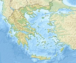 Kajmakčalan Location in Greece (on border with North Macedonia) | |
| Location | Greece–North Macedonia border |
| Parent range | Voras Mountains |

Kajmakčalan (Kaimakchalan), or Kaimaki or Kaimaktsalan or Voras (Greek: Καϊμακτσαλάν or Καϊμάκι or Βόρας, Macedonian: Каjмакчалан, romanized: Kajmakčalan), is a mountain on the border between Greece and North Macedonia. It is the southernmost and highest peak, 2,521 metres (8,271 ft),[2] of a range known in Greek as the Voras Mountains and in Macedonian as Nidže. The frontier between the two countries runs across the summit.[1] It is the third-highest peak in Greece after Mytikas and Smolikas and the fifth-highest in North Macedonia.[citation needed]
Etymology[]
The word "Kaimaktsalan" is of Ottoman Turkish origin inspired by its white, snowy peak: kaymakçalan means 'kaymak beater'. "Kaymak" in Turkish refers to a dairy product similar to clotted cream.
Geology[]
The peak consists of granite, gneiss and mica.
Climate[]
Kajmakčalan has a subarctic climate (Dfc) with short, cool summers and long, cold winters.
| hideClimate data for Kaimaktsalan Ski Center (2008-2019) Elevation: 2090m | |||||||||||||
|---|---|---|---|---|---|---|---|---|---|---|---|---|---|
| Month | Jan | Feb | Mar | Apr | May | Jun | Jul | Aug | Sep | Oct | Nov | Dec | Year |
| Record high °C (°F) | 9.4 (48.9) |
11.0 (51.8) |
9.8 (49.6) |
18.0 (64.4) |
19.7 (67.5) |
23.0 (73.4) |
25.5 (77.9) |
22.7 (72.9) |
21.3 (70.3) |
15.0 (59.0) |
13.7 (56.7) |
11.3 (52.3) |
25.5 (77.9) |
| Average high °C (°F) | −1.9 (28.6) |
−1.2 (29.8) |
0.9 (33.6) |
4.8 (40.6) |
9.3 (48.7) |
13.9 (57.0) |
16.5 (61.7) |
16.6 (61.9) |
12.1 (53.8) |
7.9 (46.2) |
4.4 (39.9) |
−0.1 (31.8) |
6.9 (44.5) |
| Daily mean °C (°F) | −4.3 (24.3) |
−3.6 (25.5) |
−1.7 (28.9) |
2 (36) |
6.2 (43.2) |
10.7 (51.3) |
13.1 (55.6) |
13.2 (55.8) |
9.1 (48.4) |
5.1 (41.2) |
2.0 (35.6) |
−2.5 (27.5) |
4.1 (39.4) |
| Average low °C (°F) | −6.7 (19.9) |
−6.2 (20.8) |
−4.3 (24.3) |
−0.6 (30.9) |
3.4 (38.1) |
7.5 (45.5) |
9.5 (49.1) |
9.5 (49.1) |
6.0 (42.8) |
2.3 (36.1) |
−0.5 (31.1) |
−5.1 (22.8) |
1.2 (34.2) |
| Record low °C (°F) | −20.8 (−5.4) |
−20.0 (−4.0) |
−16.9 (1.6) |
−11.2 (11.8) |
−4.2 (24.4) |
0.1 (32.2) |
2.6 (36.7) |
1.7 (35.1) |
−4.5 (23.9) |
−10.0 (14.0) |
−12.1 (10.2) |
−16.9 (1.6) |
−20.8 (−5.4) |
| Average precipitation mm (inches) | 78.8 (3.10) |
59.9 (2.36) |
63.6 (2.50) |
65.0 (2.56) |
106.7 (4.20) |
85.1 (3.35) |
41.0 (1.61) |
52.0 (2.05) |
98.6 (3.88) |
61.3 (2.41) |
111.7 (4.40) |
75.9 (2.99) |
899.6 (35.41) |
| Average precipitation days | 8.9 | 12.1 | 12.9 | 9.0 | 10.6 | 8.6 | 6.0 | 5.0 | 6.7 | 8.2 | 9.7 | 8.6 | 106.3 |
| Source: National Observatory of Athens[3] | |||||||||||||
History[]
During World War I, in September 1916, the Battle of Kajmakčalan between Serbian and Bulgarian troops took place at Kajmakčalan and around the adjacent peaks, resulting in a Serbian victory. There is a small church and crypt for the Serbian soldiers who died in the battle. Near the top of the mountain, on the Greek side, there is a small church named Saint Peters (Sveti Petar in Serbian), the peak itself is called, besides Kajmakčalan, Profitis Ilias (Greek: Εκκλησία Προφήτης Ηλίας).[4]
See also[]
- List of European ultra prominent peaks
References[]
- ^ Jump up to: a b c d "Europe Ultra-Prominences" The summit of Kaimaktsalan is in the Mount Voras ski area and may lie wholly within Greece. Topographic maps give the elevation as 2521m, while the ski resort literature gives the elevation as 2521m. Peaklist.org. Retrieved 2012-02-19.
- ^ "Óros Voras, Greece/North Macedonia" Peakbagger.com. Retrieved 2012-02-19.
- ^ "National Observatory of Athens". Meteo.gr. Retrieved 2020-10-05.
- ^ http://www.serbia.com/srpski/o-srbiji/istorija/srbija-u-prvom-svetskom-ratu/osmatracnica-sa-kajmakcalana/
This Central Macedonia location article is a stub. You can help Wikipedia by . |
This North Macedonia location article is a stub. You can help Wikipedia by . |
This article related to a mountain, mountain range, or peak in Greece is a stub. You can help Wikipedia by . |
External links[]
- Greece–North Macedonia border
- International mountains of Europe
- Landforms of Pella (regional unit)
- Mountains of Central Macedonia
- Two-thousanders of Greece
- Two-thousanders of North Macedonia
- Central Macedonia geography stubs
- North Macedonia geography stubs
- Greece geography stubs
- Europe mountain stubs