Mount Dyultydag
| Gora Dyultydag | |
|---|---|
| Гора Дюльтыдаг | |
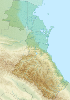
 Gora Dyultydag Location of Dyultydag in the Caucasus mountains | |
| Highest point | |
| Elevation | 4,127 m (13,540 ft)[1] |
| Prominence | 1,834 m (6,017 ft) |
| Listing | Ultra |
| Coordinates | 41°57′34″N 46°55′20″E / 41.95944°N 46.92222°ECoordinates: 41°57′34″N 46°55′20″E / 41.95944°N 46.92222°E[2] |
| Geography | |
| Location | Dagestan, Russia |
| Country | |
| Parent range | Lateral Range Caucasus Mountains |

Gora Dyultydag, or simply Dyultydag (Russian: Дюльтыдаг), is a mountain located in Dagestan, Russia. At 4,127 m (13,540 ft) elevation, it is the highest point of the Dyultydag range of the Greater Caucasus.[1][3]
Toponymy[]
Dyultydag refers to both a mountain range[4] and its higher summit, Gora Dyultydag.[5]
Sometimes the Cyrillic name Дюльтыдаг is transliterated as Dyul'tydag.[6]
Geography[]
The mountain belongs to the Samur basin. Its peak stands about 15 km (9 mi) north of the border with Azerbaijan. The closest village to Dyultydag is Archib in Charodinsky District. In 1961 its summit was reported as perennial snow-capped.[5] At an elevation of 4127 m Gora Dyultydag is Dagestan's fifth-highest mountain and the 45th-highest in Russia.[6]
See also[]
- List of European ultra prominent peaks
References[]
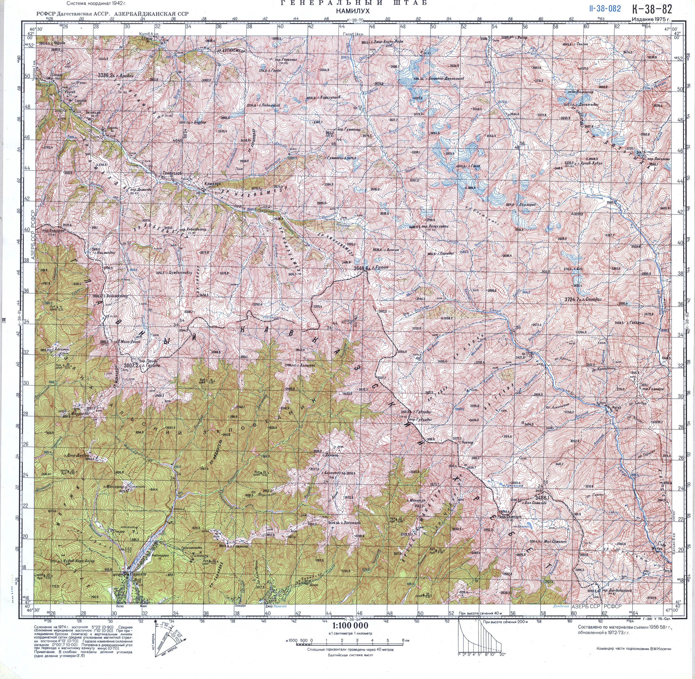
- ^ a b Soviet military map K-38-82 (1:100,000)
- ^ Гора Дюльтыдаг: Russia, web-page on www.geographic.org
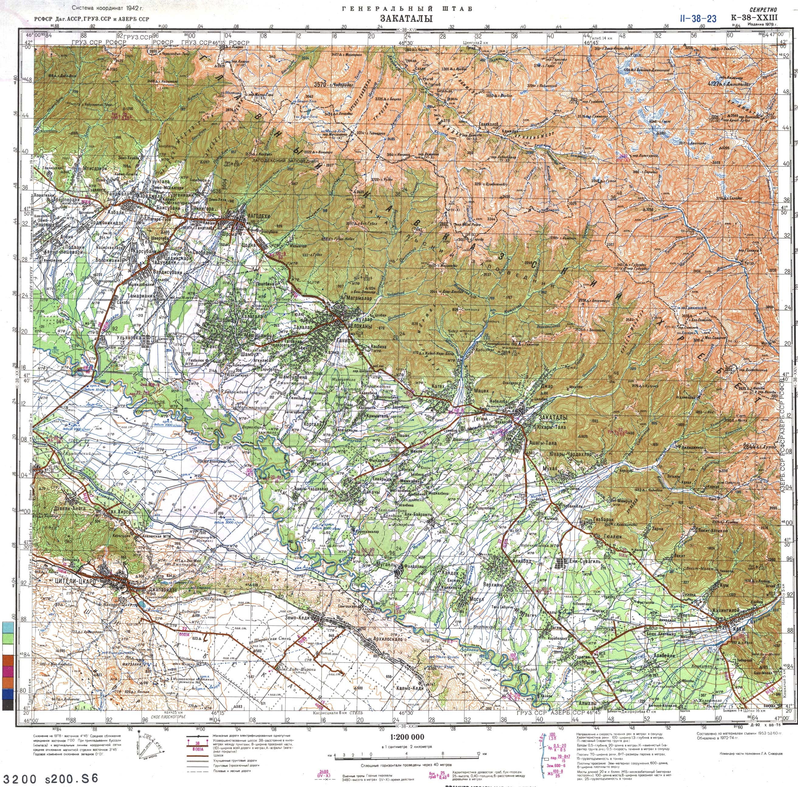
- ^ Soviet military map K-38-23 (1:200,000)
- ^ Moscow University Geology Bulletin, Volume 35. Allerton Press. 1980.
- ^ a b Florinsky, Michael T. Florinsky (1961). McGraw-Hill encyclopedia of Russia and the Soviet Union. McGraw-Hill.
- ^ a b Gora Dyul'tydag, peakery.com
External links[]
- "Gora Dyultydag, Russia". Peakbagger.com.
This Republic of Dagestan location article is a stub. You can help Wikipedia by . |
- Mountains of Dagestan
- Four-thousanders of the Caucasus
- Dagestan geography stubs