Monte Cinto
This article needs additional citations for verification. (May 2007) |
| Monte Cinto | |
|---|---|
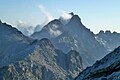
 Monte Cinto from Capu Biancu (2,562 m) | |
| Highest point | |
| Elevation | 2,706 m (8,878 ft)[1] |
| Prominence | 2,706 m (8,878 ft)[1] |
| Isolation | 223.28 km (138.74 mi) |
| Listing | Ultra |
| Coordinates | 42°22′46.86″N 8°56′44.22″E / 42.3796833°N 8.9456167°ECoordinates: 42°22′46.86″N 8°56′44.22″E / 42.3796833°N 8.9456167°E |
| Geography | |


Monte Cinto (Corsican: Monte Cintu) is the highest mountain on the island of Corsica, a region of France.
Geography[]
The elevation of the mountain is 2,706 metres (8,878 ft) and so is its prominence, making it one of the most prominent peaks in Europe. It is the highest peak of the Monte Cinto massif, one of the four main massifs in Corsica.
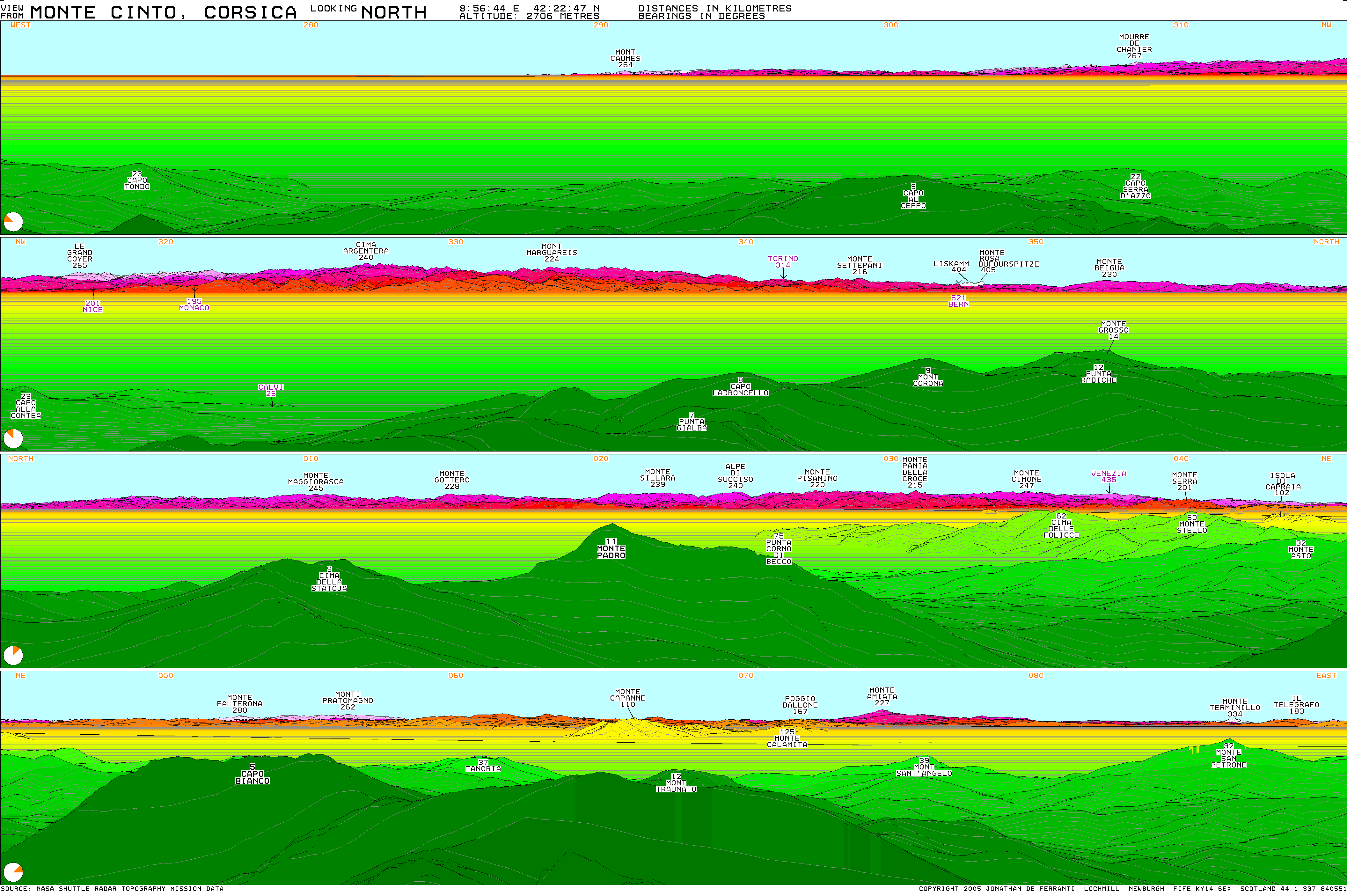
Its location gives it a theoretical panorama of mountains on mainland Europe stretching from near Marseille to Rome. The most distant mountain theoretically visible is Monte Rosa in Italy, just west of north, approximately 405 km (252 mi) away.[2]
History[]
The first known ascent of Monte Cinto was on 6 June 1882, by a party led by Édouard Rochat who reached the summit via the mountain's southern slopes. On 26 May 1883 a party led by the English mountaineer Francis Fox Tuckett, and including the guide F. Devouassoud and the landscape painter Compton, also ascended the mountain by the pass that now bears Tuckett's name.
See also[]
- List of European ultra prominent peaks
- List of islands by highest point
References[]
- ^ a b "Europe Ultra-Prominences" Peaklist.org. Retrieved 2012-03-05.
- ^ http://www.viewfinderpanoramas.org/panoramas/EUR/CINTO-N.gif
External links[]
- Computer generated digital panoramas from Monte Cinto: North South
- More information and trip report
- "Monte Cinto, France" on Peakbagger
Landforms of the Haute-Corse department | ||
|---|---|---|
| Massifs |
|  |
| Peaks |
| |
| Passes | ||
| ||
This Haute-Corse geographical article is a stub. You can help Wikipedia by . |
- Mountains of Haute-Corse
- Two-thousanders of France
- Haute-Corse geography stubs