La Celle-Saint-Cyr
La Celle-Saint-Cyr | |
|---|---|
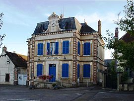 The town hall in La Celle-Saint-Cyr | |
 Coat of arms | |
show Location of La Celle-Saint-Cyr | |
 La Celle-Saint-Cyr | |
| Coordinates: 47°58′25″N 3°17′26″E / 47.9736°N 3.2906°ECoordinates: 47°58′25″N 3°17′26″E / 47.9736°N 3.2906°E | |
| Country | France |
| Region | Bourgogne-Franche-Comté |
| Department | Yonne |
| Arrondissement | Sens |
| Canton | Joigny |
| Area 1 | 18.57 km2 (7.17 sq mi) |
| Population (Jan. 2018)[1] | 810 |
| • Density | 44/km2 (110/sq mi) |
| Time zone | UTC+01:00 (CET) |
| • Summer (DST) | UTC+02:00 (CEST) |
| INSEE/Postal code | 89063 /89116 |
| Elevation | 83–197 m (272–646 ft) |
| 1 French Land Register data, which excludes lakes, ponds, glaciers > 1 km2 (0.386 sq mi or 247 acres) and river estuaries. | |


La Celle-Saint-Cyr is a commune in the Yonne department in Bourgogne-Franche-Comté in north-central France.
See also[]
References[]
- ^ "Populations légales 2018". INSEE. 28 December 2020.
| Wikimedia Commons has media related to La Celle-Saint-Cyr. |
This Yonne geographical article is a stub. You can help Wikipedia by . |
Categories:
- Communes of Yonne
- Yonne geography stubs