La Plaine-des-Palmistes
La Plaine-des-Palmistes | |
|---|---|
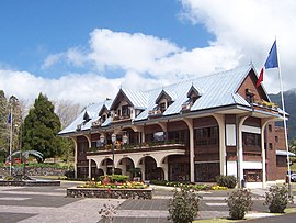 The town hall in Plaine-des-Palmistes | |
 | |
show Location of La Plaine-des-Palmistes | |
| Coordinates: 21°08′06″S 55°37′32″E / 21.1350°S 55.6256°ECoordinates: 21°08′06″S 55°37′32″E / 21.1350°S 55.6256°E | |
| Country | France |
| Overseas region and department | Réunion |
| Arrondissement | Saint-Benoît |
| Canton | Saint-Benoît-1 |
| Intercommunality | Réunion Est |
| Government | |
| • Mayor (2020–2026) | Johnny Payet[1] |
| Area 1 | 83.19 km2 (32.12 sq mi) |
| Population (Jan. 2018)[2] | 6,568 |
| • Density | 79/km2 (200/sq mi) |
| Time zone | UTC+04:00 |
| INSEE/Postal code | 97406 /97431 |
| Elevation | 720–2,402 m (2,362–7,881 ft) (avg. 1,008 m or 3,307 ft) |
| 1 French Land Register data, which excludes lakes, ponds, glaciers > 1 km2 (0.386 sq mi or 247 acres) and river estuaries. | |


La Plaine-des-Palmistes is a commune in the French overseas department of Réunion.
Geography[]
It lies in the eastern part of the island, on the RN3 road, south west of Saint-Benoît and northeast of the Col de Bellevue. It is known for its nearby forest and for the Biberon Falls. It lies close to the slopes of the Piton des Songes.
The communal territory is entirely located in the tops of the island. It borders Saint-Benoît, Sainte-Rose and Le Tampon.

Plaine-des-Palmistes
Climate[]
| hideClimate data for La Plaine-des-Palmistes (1981–2010 averages, extremes 1961–present) | |||||||||||||
|---|---|---|---|---|---|---|---|---|---|---|---|---|---|
| Month | Jan | Feb | Mar | Apr | May | Jun | Jul | Aug | Sep | Oct | Nov | Dec | Year |
| Record high °C (°F) | 29.0 (84.2) |
30.2 (86.4) |
30.5 (86.9) |
28.5 (83.3) |
26.1 (79.0) |
25.3 (77.5) |
24.0 (75.2) |
23.1 (73.6) |
24.2 (75.6) |
26.8 (80.2) |
28.5 (83.3) |
28.1 (82.6) |
30.5 (86.9) |
| Average high °C (°F) | 23.7 (74.7) |
23.7 (74.7) |
23.3 (73.9) |
22.6 (72.7) |
20.8 (69.4) |
19.0 (66.2) |
17.9 (64.2) |
17.7 (63.9) |
18.4 (65.1) |
19.4 (66.9) |
20.9 (69.6) |
22.6 (72.7) |
20.8 (69.4) |
| Daily mean °C (°F) | 19.8 (67.6) |
20.1 (68.2) |
19.5 (67.1) |
18.5 (65.3) |
16.6 (61.9) |
14.7 (58.5) |
13.7 (56.7) |
13.6 (56.5) |
14.2 (57.6) |
15.2 (59.4) |
16.6 (61.9) |
18.5 (65.3) |
16.7 (62.1) |
| Average low °C (°F) | 15.8 (60.4) |
16.4 (61.5) |
15.6 (60.1) |
14.4 (57.9) |
12.3 (54.1) |
10.5 (50.9) |
9.5 (49.1) |
9.5 (49.1) |
9.9 (49.8) |
11.1 (52.0) |
12.3 (54.1) |
14.4 (57.9) |
12.6 (54.7) |
| Record low °C (°F) | 10.0 (50.0) |
9.5 (49.1) |
9.8 (49.6) |
7.4 (45.3) |
5.2 (41.4) |
3.8 (38.8) |
3.4 (38.1) |
2.8 (37.0) |
4.5 (40.1) |
4.9 (40.8) |
5.6 (42.1) |
8.1 (46.6) |
2.8 (37.0) |
| Average precipitation mm (inches) | 728.1 (28.67) |
997.9 (39.29) |
692.6 (27.27) |
389.9 (15.35) |
273.6 (10.77) |
202.8 (7.98) |
173.1 (6.81) |
193.7 (7.63) |
181.8 (7.16) |
157.4 (6.20) |
181.7 (7.15) |
398.4 (15.69) |
4,571 (179.96) |
| Average precipitation days (≥ 1.0 mm) | 20.6 | 19.9 | 19.7 | 17.3 | 15.4 | 13.4 | 16.2 | 16.8 | 14.0 | 15.5 | 14.2 | 18.1 | 201.1 |
| Mean monthly sunshine hours | 125.3 | 111.6 | 131.3 | 128.1 | 133.6 | 136.6 | 136.6 | 130.1 | 137.8 | 126.9 | 137.0 | 119.1 | 1,553.9 |
| Source: Meteo France[3] | |||||||||||||
See also[]
References[]
- ^ "Répertoire national des élus: les maires". data.gouv.fr, Plateforme ouverte des données publiques françaises (in French). 2 December 2020. Retrieved 8 December 2020.
- ^ "Populations légales 2018". INSEE. 28 December 2020.
- ^ "Plaine-des-Palmistes (974)" (PDF). Fiche Climatologique: Statistiques 1981–2010 et records (in French). Meteo France. Archived from the original (PDF) on 20 October 2019. Retrieved 19 October 2019.
External links[]
- La Plaine-des-Palmistes at runweb.com (in French)
| Wikimedia Commons has media related to La Plaine-des-Palmistes. |
| show Authority control |
|---|
This Réunion location article is a stub. You can help Wikipedia by . |
Categories:
- Communes of Réunion
- Réunion geography stubs