Sainte-Suzanne, Réunion
Sainte-Suzanne | |
|---|---|
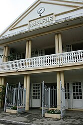 The town hall of Sainte-Suzanne | |
 | |
show Location of Sainte-Suzanne | |
| Coordinates: 20°54′20″S 55°36′26″E / 20.9056°S 55.6072°ECoordinates: 20°54′20″S 55°36′26″E / 20.9056°S 55.6072°E | |
| Country | France |
| Overseas region and department | Réunion |
| Arrondissement | Saint-Denis |
| Canton | Saint-André-1 |
| Intercommunality | Nord de la Réunion |
| Government | |
| • Mayor (2020–2026) | Maurice Gironcel[1] |
| Area 1 | 58.84 km2 (22.72 sq mi) |
| Population (Jan. 2018)[2] | 23,718 |
| • Density | 400/km2 (1,000/sq mi) |
| Time zone | UTC+04:00 |
| INSEE/Postal code | 97420 /97441 |
| Elevation | 0–1,449 m (0–4,754 ft) (avg. 5 m or 16 ft) |
| 1 French Land Register data, which excludes lakes, ponds, glaciers > 1 km2 (0.386 sq mi or 247 acres) and river estuaries. | |


Sainte-Suzanne is a commune on the north coast of the French island and department of Réunion.
Geography[]
It is bordered by the communes of Saint-André, Sainte-Marie and Salazie. The course of the denoted the border between Saint-André and Saint-Suzanne. Quartier-Français is a village in this commune.
History[]
The town, along with Saint-Denis, was founded in 1667 by Étienne Regnault, the first governor of the island.
Population[]
| Year | Pop. | ±% p.a. |
|---|---|---|
| 1968 | 11,151 | — |
| 1975 | 11,984 | +1.03% |
| 1982 | 13,196 | +1.39% |
| 1990 | 14,695 | +1.35% |
| 1999 | 18,144 | +2.37% |
| 2007 | 21,856 | +2.35% |
| 2012 | 22,388 | +0.48% |
| 2017 | 23,505 | +0.98% |
| Source: INSEE[3] | ||
Personalities[]
The following people were natives of Sainte-Suzanne:
- Edmond Albius (1829–1880), a slave who discovered the artificial pollination of vanilla.
- Élie Hoarau (born 1938), politician.
- René-Paul Victoria (born 1954), politician.
See also[]
References[]
- ^ "Répertoire national des élus: les maires". data.gouv.fr, Plateforme ouverte des données publiques françaises (in French). 2 December 2020. Retrieved 8 December 2020.
- ^ "Populations légales 2018". INSEE. 28 December 2020.
- ^ Population en historique depuis 1968, INSEE
External links[]
| Wikimedia Commons has media related to Sainte-Suzanne (Réunion). |
| show Authority control |
|---|
This Réunion location article is a stub. You can help Wikipedia by . |
Categories:
- Sainte-Suzanne, Réunion
- Communes of Réunion
- Réunion geography stubs