Saint-Louis, Réunion
Saint-Louis | |
|---|---|
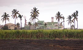 The sugarcane factory and the bagasse/coal dual power plant of Gol, in Saint-Louis | |
 Coat of arms | |
 | |
show Location of Saint-Louis | |
| Coordinates: 21°17′12″S 55°24′33″E / 21.2867°S 55.4092°ECoordinates: 21°17′12″S 55°24′33″E / 21.2867°S 55.4092°E | |
| Country | France |
| Overseas region and department | Réunion |
| Arrondissement | Saint-Pierre |
| Canton | Saint-Louis-1 and 2 |
| Intercommunality | Villes solidaires |
| Government | |
| • Mayor (2020–2026) | Juliana M'Doihoma[1] |
| Area 1 | 98.90 km2 (38.19 sq mi) |
| Population (Jan. 2018)[2] | 53,589 |
| • Density | 540/km2 (1,400/sq mi) |
| Time zone | UTC+04:00 |
| INSEE/Postal code | 97414 /97450 |
| Elevation | 0–2,543 m (0–8,343 ft) (avg. 31 m or 102 ft) |
| 1 French Land Register data, which excludes lakes, ponds, glaciers > 1 km2 (0.386 sq mi or 247 acres) and river estuaries. | |


Saint-Louis (French pronunciation: [sɛ̃.lwi]) is the fifth-largest commune in the French overseas department of Réunion. It is located on the southwest part of the island of Réunion, adjacent to Saint-Pierre.
Population[]
| Year | Pop. | ±% p.a. |
|---|---|---|
| 1961 | 23,998 | — |
| 1967 | 26,663 | +1.77% |
| 1974 | 30,291 | +1.84% |
| 1982 | 31,785 | +0.60% |
| 1990 | 37,420 | +2.06% |
| 1999 | 43,519 | +1.69% |
| 2007 | 50,131 | +1.78% |
| 2012 | 52,614 | +0.97% |
| 2017 | 53,365 | +0.28% |
| Source: SPLAF[3] and INSEE (1967-2017)[4] | ||
See also[]
References[]
- ^ "Répertoire national des élus: les maires". data.gouv.fr, Plateforme ouverte des données publiques françaises (in French). 2 December 2020. Retrieved 8 December 2020.
- ^ "Populations légales 2018". INSEE. 28 December 2020.
- ^ SPLAF (Site sur la Population et les Limites Administratives de la France). "Agglomérations et villes de la Réunion". Retrieved 23 February 2021.
- ^ Population en historique depuis 1968, INSEE
External links[]
| Wikimedia Commons has media related to Saint-Louis (Réunion). |
- City council website (in French)
This Réunion location article is a stub. You can help Wikipedia by . |
Categories:
- Communes of Réunion
- Réunion geography stubs