Le Tampon
Le Tampon | |
|---|---|
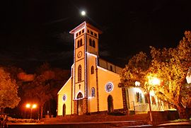 The church of Le Tampon | |
 | |
show Location of Le Tampon | |
| Coordinates: 21°16′41″S 55°30′55″E / 21.2781°S 55.5153°ECoordinates: 21°16′41″S 55°30′55″E / 21.2781°S 55.5153°E | |
| Country | France |
| Overseas region and department | Réunion |
| Arrondissement | Saint-Pierre |
| Canton | 2 cantons |
| Intercommunality | CA du Sud |
| Government | |
| • Mayor (2020–2026) | André Thien Ah Koon[1] |
| Area 1 | 165.43 km2 (63.87 sq mi) |
| Population (Jan. 2018)[2] | 79,385 |
| • Density | 480/km2 (1,200/sq mi) |
| Time zone | UTC+04:00 |
| INSEE/Postal code | 97422 /97430 |
| Elevation | 287–2,418 m (942–7,933 ft) (avg. 546 m or 1,791 ft) |
| 1 French Land Register data, which excludes lakes, ponds, glaciers > 1 km2 (0.386 sq mi or 247 acres) and river estuaries. | |


Le Tampon (French pronunciation: [lə.tɑ̃.pɔ̃]) is the fourth-largest commune in the French overseas department of Réunion. It is located on the south-central part of the island of Réunion, adjacent to Saint-Pierre.
In the early twentieth century, the town was the base for the murderer and sorcerer Sitarane.[3]
Population[]
| Year | Pop. | ±% p.a. |
|---|---|---|
| 1961 | 24,335 | — |
| 1967 | 31,378 | +4.33% |
| 1974 | 36,107 | +2.03% |
| 1982 | 40,545 | +1.46% |
| 1990 | 47,593 | +2.02% |
| 1999 | 60,323 | +2.67% |
| 2007 | 70,539 | +1.97% |
| 2012 | 75,631 | +1.40% |
| 2017 | 78,629 | +0.78% |
| Source: SPLAF[4] and INSEE (1967-2017)[5] | ||
See also[]
References[]
- ^ "Répertoire national des élus: les maires". data.gouv.fr, Plateforme ouverte des données publiques françaises (in French). 2 December 2020. Retrieved 8 December 2020.
- ^ "Populations légales 2018". INSEE. 28 December 2020.
- ^ Iledelareunion.net: Sitarane (in French)
- ^ SPLAF (la Population et les Limites Administratives de la France). "Agglomérations et villes de la Réunion" [Towns and cities of Reunion Island]. Retrieved 23 February 2021.
- ^ Population en historique depuis 1968, INSEE
External links[]
- Official website (in French)
| Wikimedia Commons has media related to Le Tampon. |
| show Authority control |
|---|
This Réunion location article is a stub. You can help Wikipedia by . |
Categories:
- Communes of Réunion
- Réunion geography stubs