Petite-Île
Petite-Île | |
|---|---|
 The coastline of Petite-Île | |
 Coat of arms | |
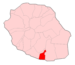 | |
show Location of Petite-Île | |
| Coordinates: 21°21′21″S 55°33′57″E / 21.3558°S 55.5658°ECoordinates: 21°21′21″S 55°33′57″E / 21.3558°S 55.5658°E | |
| Country | France |
| Overseas region and department | Réunion |
| Arrondissement | Saint-Pierre |
| Canton | Saint-Pierre-3 |
| Intercommunality | Villes solidaires |
| Government | |
| • Mayor (2020–2026) | Serge Hoareau[1] |
| Area 1 | 33.93 km2 (13.10 sq mi) |
| Population (Jan. 2018)[2] | 12,308 |
| • Density | 360/km2 (940/sq mi) |
| Time zone | UTC+04:00 |
| INSEE/Postal code | 97405 /97429 |
| Elevation | 0–1,581 m (0–5,187 ft) (avg. 307 m or 1,007 ft) |
| 1 French Land Register data, which excludes lakes, ponds, glaciers > 1 km2 (0.386 sq mi or 247 acres) and river estuaries. | |


Petite-Île (French: Little Isle) is a commune on the French island and department of Réunion. The commune is bordered by the communes of Saint-Joseph to the east and Saint-Pierre to the west. The commune gets its name from the uninhabited islet off of its coast, the only such islet near Réunion that has vegetation. The commune was established in 1935.
Economy[]
The main economy in the commune is agriculture-based, with cane sugar plantations, along with fruit and vegetable farming.
See also[]
References[]
- ^ "Répertoire national des élus: les maires". data.gouv.fr, Plateforme ouverte des données publiques françaises (in French). 2 December 2020. Retrieved 8 December 2020.
- ^ "Populations légales 2018". INSEE. 28 December 2020.
External links[]
- Official website (in French)
- Site of the CIVIS (in French)
| Wikimedia Commons has media related to Petite-Île. |
This Réunion location article is a stub. You can help Wikipedia by . |
Categories:
- Communes of Réunion
- Réunion geography stubs