Larmor-Baden
Larmor-Baden
An Arvor-Baden | |
|---|---|
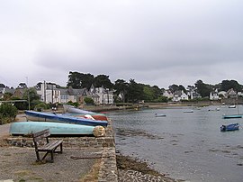 A view of the bay of Port Lagaden | |
 Coat of arms | |
show Location of Larmor-Baden | |
 Larmor-Baden | |
| Coordinates: 47°35′16″N 2°53′45″W / 47.5878°N 2.8958°WCoordinates: 47°35′16″N 2°53′45″W / 47.5878°N 2.8958°W | |
| Country | France |
| Region | Brittany |
| Department | Morbihan |
| Arrondissement | Vannes |
| Canton | Vannes-2 |
| Intercommunality | Golfe du Morbihan - Vannes Agglomération |
| Government | |
| • Mayor (2020–2026) | Denis Bertholom[1] |
| Area 1 | 3.93 km2 (1.52 sq mi) |
| Population (Jan. 2018)[2] | 878 |
| • Density | 220/km2 (580/sq mi) |
| Time zone | UTC+01:00 (CET) |
| • Summer (DST) | UTC+02:00 (CEST) |
| INSEE/Postal code | 56106 /56870 |
| Elevation | 0–26 m (0–85 ft) |
| 1 French Land Register data, which excludes lakes, ponds, glaciers > 1 km2 (0.386 sq mi or 247 acres) and river estuaries. | |


Larmor-Baden (Breton: An Arvor-Baden) is a commune in the Morbihan department of Brittany in northwestern France.
The inhabitants of Larmor-Baden are called in French Larmoriens.
Île de Berder[]

Île Berder in the Gulf of Morbihan.
Île de Berder (French for "The Island of Berder") is a small island off Larmor-Baden. In reality Berder is not a true island as it is attached to the mainland by submerged land that shows at low tide. The name Berder comes from the Breton word Breudeur, meaning brothers.
The island lies in the Gulf of Morbihan, and has a position relative to other islands:
- south of Port-Blanc
- north of
- west of
- east of and the mainland (Larmor-Baden).
See also[]
References[]
- ^ "Maires du Morbihan" (PDF). Préfecture du Morbihan. 7 July 2020.
- ^ "Populations légales 2018". INSEE. 28 December 2020.
External links[]
- Base Mérimée: Search for heritage in the commune, Ministère français de la Culture. (in French)
- Mayors of Morbihan Association (in French)
| Wikimedia Commons has media related to Larmor-Baden. |
| show Authority control |
|---|
This Morbihan geographical article is a stub. You can help Wikipedia by . |
Categories:
- Communes of Morbihan
- Morbihan geography stubs