Longnan
Longnan
陇南市 | |
|---|---|
 | |
 Location of Longnan City jurisdiction in Gansu | |
| Coordinates (Longnan municipal government): 33°22′13″N 104°57′37″E / 33.3702°N 104.9603°ECoordinates: 33°22′13″N 104°57′37″E / 33.3702°N 104.9603°E | |
| Country | People's Republic of China |
| Province | Gansu |
| Municipal seat | Wudu District |
| Area | |
| • Total | 27,000 km2 (10,000 sq mi) |
| Population (2010)[1] | |
| • Total | 2,567,718 |
| • Density | 95/km2 (250/sq mi) |
| Time zone | UTC+8 (China Standard) |
| Postal code | 742500 |
| Area code(s) | 0939 |
| ISO 3166 code | CN-GS-12 |
| Licence plate prefixes | 甘K |
| Website | www |

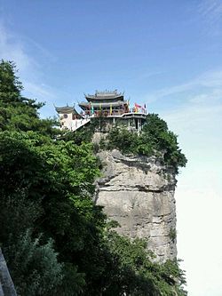
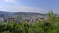
Longnan (simplified Chinese: 陇南; traditional Chinese: 隴南; pinyin: Lǒngnán; lit. '"south of Mount Long"[2]') is a prefecture-level city in the southeast of Gansu province in China. It borders Sichuan on its south and Shaanxi on its east.
Geography and climate[]
Longnan is in southern Gansu province bordering Shaanxi in the east and Sichuan in the south. It is called Gansu's southern gateway and gateway to the northwest. The major geographic features in Longnan are the Qinba Mountains in the east, the Loess Plateau in the north, and the Tibetan Plateau in the west. It is part of the Central Han basin in the east and the Sichuan basin in the south. Elevations range from 800 to 4,200 m (2,620 to 13,780 ft) above sea level. The three major rivers in Longnan are the Bailong, the , and the Jialing. Besides these major rivers there are more than 3800 streams and creeks. The annual flow from all of these rivers and streams is more than 28 billion m3. The area of the prefecture is 27,000 square kilometres (10,000 sq mi).
Longnan has a temperate, monsoon-influenced semi-arid climate (Köppen BSk/BSh, depending on the source definition), with cool and very dry winters and hot, moderately humid summers. Due to the protected valley location and the southerly location in the province, the area is one of the warmest in Gansu, with annual temperatures ranging from 10 to 15 °C (50 to 59 °F). The annual precipitation is 400 to 1,000 mm (16 to 39 in), while there are between 160 to 280 frost free days. With monthly percent possible sunshine ranging from 34% in September and October to 53% in December, the city receives 1,850 sunlight hours annually. Two-thirds of the annual rainfall occurs from June to September. At Wudu, the monthly 24-hour average temperature ranges from 3.7 °C (38.7 °F) in January to 25.2 °C (77.4 °F) in July, the annual mean is 14.94 °C (58.9 °F), and the annual precipitation is 461 mm (18.1 in).
| hideClimate data for Longnan (Wudu District, 1981−2010 normals) | |||||||||||||
|---|---|---|---|---|---|---|---|---|---|---|---|---|---|
| Month | Jan | Feb | Mar | Apr | May | Jun | Jul | Aug | Sep | Oct | Nov | Dec | Year |
| Record high °C (°F) | 15.3 (59.5) |
21.6 (70.9) |
29.2 (84.6) |
33.2 (91.8) |
35.7 (96.3) |
37.6 (99.7) |
38.3 (100.9) |
38.6 (101.5) |
37.0 (98.6) |
29.2 (84.6) |
23.0 (73.4) |
17.3 (63.1) |
38.6 (101.5) |
| Average high °C (°F) | 8.3 (46.9) |
11.2 (52.2) |
15.9 (60.6) |
21.9 (71.4) |
26.3 (79.3) |
28.9 (84.0) |
30.8 (87.4) |
29.9 (85.8) |
24.8 (76.6) |
19.6 (67.3) |
14.9 (58.8) |
9.4 (48.9) |
20.2 (68.3) |
| Daily mean °C (°F) | 3.7 (38.7) |
6.5 (43.7) |
10.7 (51.3) |
16.0 (60.8) |
20.2 (68.4) |
23.1 (73.6) |
25.2 (77.4) |
24.3 (75.7) |
19.9 (67.8) |
15.1 (59.2) |
10.0 (50.0) |
4.6 (40.3) |
14.9 (58.9) |
| Average low °C (°F) | 0.0 (32.0) |
3.0 (37.4) |
6.8 (44.2) |
11.5 (52.7) |
15.4 (59.7) |
18.6 (65.5) |
20.8 (69.4) |
20.2 (68.4) |
16.5 (61.7) |
11.8 (53.2) |
6.3 (43.3) |
0.8 (33.4) |
11.0 (51.7) |
| Record low °C (°F) | −7.5 (18.5) |
−7.8 (18.0) |
−3.6 (25.5) |
−2.1 (28.2) |
5.1 (41.2) |
10.1 (50.2) |
14.8 (58.6) |
12.3 (54.1) |
8.4 (47.1) |
0.9 (33.6) |
−4.8 (23.4) |
−8.6 (16.5) |
−8.6 (16.5) |
| Average precipitation mm (inches) | 1.8 (0.07) |
2.8 (0.11) |
12.6 (0.50) |
32.1 (1.26) |
58.7 (2.31) |
68.3 (2.69) |
80.0 (3.15) |
85.5 (3.37) |
75.8 (2.98) |
35.9 (1.41) |
6.6 (0.26) |
0.7 (0.03) |
460.8 (18.14) |
| Average precipitation days (≥ 0.1 mm) | 1.9 | 2.7 | 7.7 | 10.4 | 13.1 | 13.9 | 12.4 | 12.0 | 13.3 | 11.7 | 4.0 | 1.1 | 104.2 |
| Average relative humidity (%) | 51 | 50 | 51 | 52 | 54 | 59 | 62 | 64 | 69 | 67 | 58 | 53 | 58 |
| Mean monthly sunshine hours | 151.8 | 127.2 | 135.6 | 167.0 | 178.9 | 164.0 | 184.4 | 187.6 | 127.1 | 120.7 | 143.5 | 161.8 | 1,849.6 |
| Percent possible sunshine | 48 | 41 | 37 | 43 | 42 | 38 | 42 | 45 | 34 | 34 | 46 | 53 | 42 |
| Source: China Meteorological Administration (precipitation days and sunshine 1971–2000)[3][4] | |||||||||||||
History[]
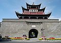
Longnan was settled by humans at least 7000 years ago. Between 5000 and 6000 years ago, civilizations developed along the Xihan ("Western Han") and Bailong ("White Dragon") rivers. Anping in Wudu as well as Lixian both have ancient ruins. Longnan is very important in Chinese history: it was the home of Rong tribes that troubled the Shang and Zhou dynasties and is considered the homeland of the House of Ying, the family of the Qin dynasty that united China at the end of the Warring States period. Wudu County was even founded as part of the Qin Empire. It is still common to find Qin artifacts—including pottery, bronzes, and coins—in the area.
During the Sixteen Kingdoms period, the region was ruled by the Qiang kingdoms of Later Qin and Tanchang, the latter has its capital in present-day Tanchang. Tanchang is conquered by Emperor Wu of Northern Zhou in 564. The region then went under control of Sui, Tang and Song dynasties, then subsequently conquered by the Tibetans, Tanguts, Jurchens and Mongols before finally administered by Ming dynasty court.
Administration[]
Longnan has 1 urban districts, 8 counties, 242 towns, and 3243 villages with a total population of 2567718.[5]
| Map | ||||||
|---|---|---|---|---|---|---|
| # | Name | Simplified Chinese | Hanyu Pinyin | Population (2010 census) |
Area (km²) | Density (/km²) |
| City proper | ||||||
| 1 | Wudu District | 武都区 | Wǔdū Qū | 555,004 | 4,642 | 119.56 |
| Rural | ||||||
| 2 | Cheng County | 成县 | Chéng Xiàn | 242,343 | 1,678 | 144.42 |
| 3 | Wen County | 文县 | Wén Xiàn | 218,796 | 5,002 | 43.74 |
| 4 | Tanchang County | 宕昌县 | Tànchāng Xiàn | 274,313 | 3,315 | 82.75 |
| 5 | Kang County | 康县 | Kāng Xiàn | 180,061 | 2,968 | 60.67 |
| 6 | Xihe County | 西和县 | Xīhé Xiàn | 393,272 | 1,862 | 211.21 |
| 7 | Li County | 礼县 | Lǐ Xiàn | 458,237 | 4,264 | 107.47 |
| 8 | Hui County | 徽县 | Huī Xiàn | 200,294 | 2,699 | 74.21 |
| 9 | Liangdang County | 两当县 | Liǎngdāng Xiàn | 45,398 | 1,408 | 32.24 |

Economy[]
In 2004, Longnan's GDP was 6,338,000,000 RMB, a 12% growth over the previous year.
Important agricultural products include cereals and grains, Chinese medicinal herbs, vegetable oil, fruits, nuts, berries, and vegetables. Coal, copper, lead, zinc, petroleum, and gold are all major mineral resources for Longnan. Cement and other building materials are also produced here.
Transportation[]
- Longnan Chengxian Airport
- China National Highway 212
- G75 Lanzhou–Haikou Expressway
- Chongqing–Lanzhou railway
- Baoji–Chengdu railway (stations only available in Hui County and Liangdang County)
- Tianshui–Longnan railway (under construction)
Flora and fauna[]
Longnan has more than 1300 species of trees and shrubs, 1300 plants and herbs used for Chinese medicine, 100 wild fruits and berries, and 300 species of animals, many species of which are protected.
Notes[]
- ^ Main data bulletin of the sixth national census in 2010, 2011-05-09(in Chinese)
- ^ Gansu's provincial abbreviation 陇 refers to Mount Long. "Longnan" originally referred to the area south of the mountain, just as Longxi was the area to its west.
- ^ 中国气象数据网 - WeatherBk Data (in Chinese). China Meteorological Administration. Retrieved 2020-04-15.
- ^ 中国地面国际交换站气候标准值月值数据集(1971-2000年). China Meteorological Administration. Archived from the original on 2013-09-21. Retrieved 2010-05-25.
- ^ Main data bulletin of the sixth national census in 2010 Archived 2014-11-29 at the Wayback Machine, 2011-05-09(in Chinese)
External links[]
- Official Website (in Chinese)


- Longnan
- Prefecture-level divisions of Gansu