Melangguane Airport
Melangguane Airport Bandar Udara Melonguane | |||||||||||
|---|---|---|---|---|---|---|---|---|---|---|---|
| Summary | |||||||||||
| Airport type | Public | ||||||||||
| Operator | Government | ||||||||||
| Serves | Melonguane, Talaud Islands Regency, North Sulawesi, Indonesia | ||||||||||
| Elevation AMSL | 4.3 m / 14 ft | ||||||||||
| Coordinates | 04°00′25″N 126°40′22″E / 4.00694°N 126.67278°ECoordinates: 04°00′25″N 126°40′22″E / 4.00694°N 126.67278°E | ||||||||||
| Map | |||||||||||
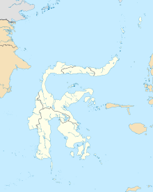 MNA Location in Sulawesi | |||||||||||
| Runways | |||||||||||
| |||||||||||

Melangguane Airport, also known as Melonguane Airport (Indonesian: Bandar Udara Melonguane) (IATA: MNA, ICAO: WAMN), is an airport serving the city of , located within the Talaud Islands Regency, part of the province of North Sulawesi on the island of Karakelong in Indonesia.
Airlines and destinations[]
| Airlines | Destinations |
|---|---|
| Wings Air | Manado |
Facilities[]
The airport resides at an elevation of 4.3 metres (14 ft) above mean sea level. It has one runway designated 18/36 with an asphalt surface measuring 1,480 by 30 metres (4,856 ft × 98 ft).
References[]
- ^ "Direktorat Jenderal Perhubungan Udara".
- ^ Airport information for MNA at Great Circle Mapper.
- ^ Airport information for Melangguane Airport at Transport Search website.
This article about an Indonesian airport is a stub. You can help Wikipedia by . |
This North Sulawesi location article is a stub. You can help Wikipedia by . |
Categories:
- Airports in North Sulawesi
- Indonesian airport stubs
- Sulawesi geography stubs