Umbu Mehang Kunda Airport
Umbu Mehang Kunda Airport Bandar Udara Umbu Mehang Kunda | |||||||||||
|---|---|---|---|---|---|---|---|---|---|---|---|
 | |||||||||||
| Summary | |||||||||||
| Airport type | Public | ||||||||||
| Serves | Waingapu, East Nusa Tenggara, Indonesia | ||||||||||
| Elevation AMSL | 33 ft / 10 m | ||||||||||
| Coordinates | 09°40′09″S 120°18′07″E / 9.66917°S 120.30194°ECoordinates: 09°40′09″S 120°18′07″E / 9.66917°S 120.30194°E | ||||||||||
| Map | |||||||||||
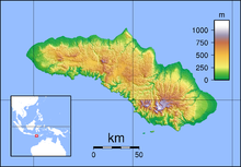 Mau Location of airport in Sumba | |||||||||||
| Runways | |||||||||||
| |||||||||||

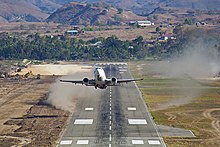
NAM Air Boeing 737-500 taking off from Umbu Mehang Kunda Airport
Umbu Mehang Kunda Airport (Indonesian: Bandar Udara Umbu Mehang Kunda) (IATA: WGP[3], ICAO: WATU[2], formerly WRRW[4]), also formerly known as Mau Hau Airport, is an airport serving Waingapu, the largest town on the island of Sumba, in the province of East Nusa Tenggara in Indonesia.
The Airport is inaugurated a new terminal on 2016 which is able to improve passenger services from the previous old terminal. There are some car parking lots and taxi stand outside the terminal.
Facilities[]
The airport resides at an elevation of 33 feet (10 m) above mean sea level. It has one runway designated 15/33 with an asphalt surface measuring 2,200 by 45 metres (7,218 ft × 148 ft).[1]
Airlines and destinations[]
| Airlines | Destinations |
|---|---|
| Citilink | Kupang |
| Nam Air | Denpasar, Kupang |
| Susi Air | Ruteng, Savu |
| TransNusa | Kupang |
| Wings Air | Denpasar, Makassar, Kupang |
References[]
- ^ Jump up to: a b Airport information for WADW from DAFIF (effective October 2006)
- ^ Jump up to: a b Airport information for WGP / WATU at Great Circle Mapper. Source: DAFIF (effective October 2006).
- ^ Accident history for WGP / WATU at Aviation Safety Network
- ^ Airport information for WRRW at Great Circle Mapper.
External links[]
Categories:
- Sumba
- Airports in East Nusa Tenggara