Monampteuil
This article may be expanded with text translated from the corresponding article in French. (December 2008) Click [show] for important translation instructions.
|
Monampteuil | |
|---|---|
Commune | |
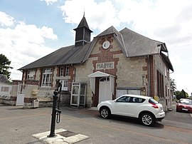 The town hall of Monampteuil | |
Location of Monampteuil  | |
 Monampteuil | |
| Coordinates: 49°28′36″N 3°34′24″E / 49.4767°N 3.5733°ECoordinates: 49°28′36″N 3°34′24″E / 49.4767°N 3.5733°E | |
| Country | France |
| Region | Hauts-de-France |
| Department | Aisne |
| Arrondissement | Soissons |
| Canton | Fère-en-Tardenois |
| Intercommunality | |
| Government | |
| • Mayor (2014-2020) | Claude Courtet |
| Area 1 | 5.86 km2 (2.26 sq mi) |
| Population (Jan. 2018)[1] | 129 |
| • Density | 22/km2 (57/sq mi) |
| Time zone | UTC+01:00 (CET) |
| • Summer (DST) | UTC+02:00 (CEST) |
| INSEE/Postal code | 02490 /02000 |
| Elevation | 64–189 m (210–620 ft) (avg. 153 m or 502 ft) |
| 1 French Land Register data, which excludes lakes, ponds, glaciers > 1 km2 (0.386 sq mi or 247 acres) and river estuaries. | |

Monampteuil is a commune in the Aisne department in Hauts-de-France in northern France.
Geography[]
The river Ailette forms part of the commune's southern border.
Population[]
| Year | Pop. | ±% |
|---|---|---|
| 2005 | 134 | — |
| 2006 | 132 | −1.5% |
| 2007 | 129 | −2.3% |
| 2008 | 132 | +2.3% |
| 2009 | 134 | +1.5% |
| 2010 | 137 | +2.2% |
| 2011 | 134 | −2.2% |
| 2012 | 133 | −0.7% |
| 2013 | 133 | +0.0% |
| 2014 | 132 | −0.8% |
| 2015 | 131 | −0.8% |
| 2016 | 131 | +0.0% |
See also[]
References[]
- ^ "Populations légales 2018". INSEE. 28 December 2020.
| Wikimedia Commons has media related to Monampteuil. |
| Prefecture |
|
|---|---|
| Subprefectures |
|
| Other |
|
| Authority control |
|
|---|
This Soissons arrondissement geographical article is a stub. You can help Wikipedia by . |
Categories:
- Communes of Aisne
- Soissons arrondissement geography stubs