Montrond-les-Bains
Montrond-les-Bains | |
|---|---|
Commune | |
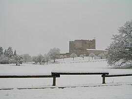 Château de Montrond | |
 Coat of arms | |
show Location of Montrond-les-Bains | |
 Montrond-les-Bains | |
| Coordinates: 45°38′38″N 4°13′53″E / 45.6439°N 4.2314°ECoordinates: 45°38′38″N 4°13′53″E / 45.6439°N 4.2314°E | |
| Country | France |
| Region | Auvergne-Rhône-Alpes |
| Department | Loire |
| Arrondissement | Montbrison |
| Canton | Andrézieux-Bouthéon |
| Intercommunality | Forez-Est |
| Government | |
| • Mayor (2020–2026) | Serge Percet |
| Area 1 | 10.11 km2 (3.90 sq mi) |
| Population (Jan. 2018)[1] | 5,290 |
| • Density | 520/km2 (1,400/sq mi) |
| Time zone | UTC+01:00 (CET) |
| • Summer (DST) | UTC+02:00 (CEST) |
| INSEE/Postal code | 42149 /42210 |
| Elevation | 333–369 m (1,093–1,211 ft) |
| 1 French Land Register data, which excludes lakes, ponds, glaciers > 1 km2 (0.386 sq mi or 247 acres) and river estuaries. | |


Montrond-les-Bains (French pronunciation: [mɔ̃ʁɔ̃ le bɛ̃]) is a commune in the Loire department in central France.
Population[]
|
|
See also[]
References[]
- ^ "Populations légales 2018". INSEE. 28 December 2020.
| Wikimedia Commons has media related to Montrond-les-Bains. |
| show Authority control |
|---|
This Loire geographical article is a stub. You can help Wikipedia by . |
Categories:
- Communes of Loire (department)
- Loire geography stubs