Mount Pleasant station (Toronto)
Mount Pleasant | |||||||||||
|---|---|---|---|---|---|---|---|---|---|---|---|
 Second Cup coffee shop in the old bank building will be the location of the main station entrance.[1] | |||||||||||
| Location | Eglinton Avenue & Mount Pleasant Road Toronto, Ontario Canada | ||||||||||
| Coordinates | 43°42′30.2″N 79°23′24.6″W / 43.708389°N 79.390167°WCoordinates: 43°42′30.2″N 79°23′24.6″W / 43.708389°N 79.390167°W | ||||||||||
| Platforms | Centre platform | ||||||||||
| Tracks | 2 | ||||||||||
| Connections | |||||||||||
| Construction | |||||||||||
| Structure type | Underground | ||||||||||
| Disabled access | Yes | ||||||||||
| Other information | |||||||||||
| Status | Under construction | ||||||||||
| History | |||||||||||
| Opening | 2022[2] | ||||||||||
| Services | |||||||||||
| |||||||||||

Mount Pleasant is an underground light rail transit (LRT) station under construction on Line 5 Eglinton, a new line that is part of the Toronto subway system.[3] The station will be located in North Toronto at the intersection of Mount Pleasant Road and Eglinton Avenue. Nearby destinations include Northern Secondary School and the Davisville Village neighbourhood. It is scheduled to open in 2022.
Description[]
The station will have two entrances. The main, accessible entrance will be at the northwest corner of Eglinton Avenue and Mt. Pleasant Road. The secondary entrance will be just east of Mount Pleasant Road on the north side. The station will have storage for 30 bicycles.[3]
The main entrance of the station at 256–258 Eglinton Avenue East was the location of a former branch of the Imperial Bank of Canada, in a building designed by architect Herbert Horner in 1928. Metrolinx had the building's façade disassembled brick-by-brick, cataloged, labelled and stored for reassembly upon completion of station structure. Only the building's façade will be preserved.[1][4]
Surface connections[]
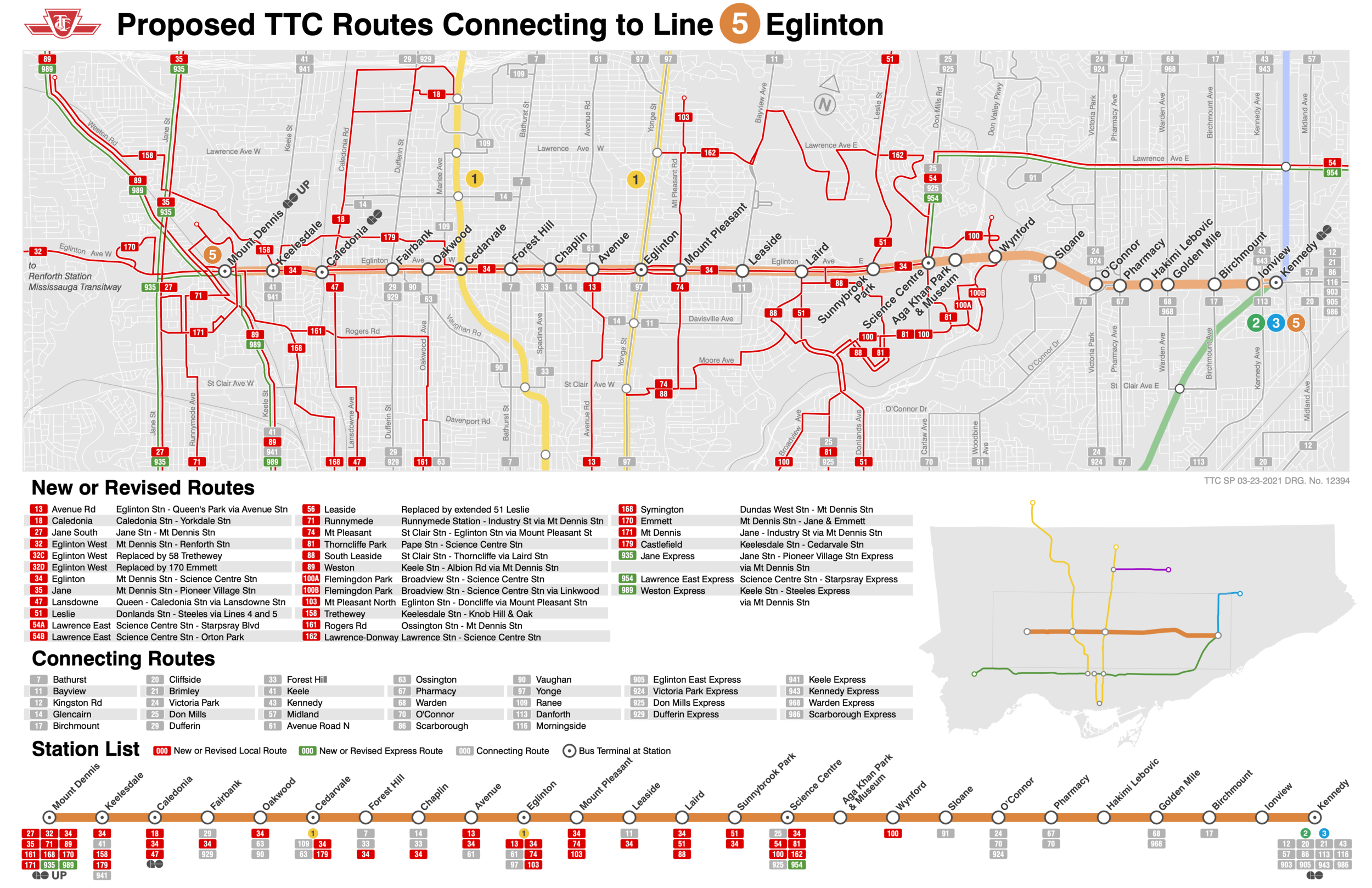
As of June 2021, the following are the proposed routes that would serve this station when Line 5 Eglinton opens:[5][6]
| Route | Name | Additional information |
|---|---|---|
| 34 | Eglinton | Westbound to Mount Dennis station and eastbound to Science Centre station |
| 74 | Mount Pleasant | Southbound to St. Clair station and westbound to Eglinton station |
| 103 | Mount Pleasant North | Southbound to Eglinton station and northbound to Doncliffe loop |
References[]
- ^ Jump up to: a b
"McDonalds to be demolished for Bayview LRT". . November 7, 2013. Retrieved October 21, 2015.
A nice bit of news on the northwest corner of Mt Pleasant and Eglinton where, according to Metrolinx information, the facade of the old building will be retained.
- ^ Spurr, Ben (February 17, 2020). "Eglinton Crosstown faces another setback, delayed until 2022". Toronto Star. Retrieved February 18, 2020.
- ^ Jump up to: a b "Mount Pleasant Station". Eglinton Crosstown. Retrieved October 31, 2015.
- ^ "Mount Pleasant Station Open House". Metrolinx. October 19, 2017. Retrieved March 31, 2017.
•Designed by architect Herbert Horner in 1928, and established as an Imperial Bank of Canada. •In July 2016 demolition of the 256–258 Eglinton Avenue East began. •The façade was disassembled brick-by-brick, cataloged, labelled and stored. •The east portion of the façade will be reassebled upon completion of station structure.
From slide 32 of url's slideshow. - ^ Munro, Steve (June 27, 2021). "TTC 2022 Service Plan Consultation". Steve Munro. Retrieved June 29, 2021.
- ^ "Proposed TTC Routes Connecting to Line 5 Eglinton". Toronto Transit Commission. Retrieved June 29, 2021.
External links[]
- Mount Pleasant Station project page at the Eglinton Crosstown website.
This Toronto-related article is a stub. You can help Wikipedia by . |
This rapid transit-related article is a stub. You can help Wikipedia by . |
This article about a railway station in Canada is a stub. You can help Wikipedia by . |
- Line 5 Eglinton stations
- Toronto Transit Commission stations located underground
- Toronto stubs
- Rapid transit stubs
- Canadian railway station stubs