Municipal District of Wainwright No. 61
Municipal District of Wainwright No. 61 | |
|---|---|
 Welcome sign | |
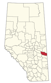 Location within Alberta | |
| Coordinates: 52°50′36″N 110°51′12″W / 52.84333°N 110.85333°WCoordinates: 52°50′36″N 110°51′12″W / 52.84333°N 110.85333°W | |
| Country | Canada |
| Province | Alberta |
| Region | Central Alberta |
| Census division | 7 |
| Established | 1942 |
| Incorporated | 1942 |
| Government | |
| • Reeve | Bob Barss |
| • Governing body | MD of Wainwright Council |
| • Administrative office | Wainwright |
| Area (2016)[2] | |
| • Land | 4,156.56 km2 (1,604.86 sq mi) |
| Population (2016)[2] | |
| • Total | 4,479 |
| • Density | 1.1/km2 (3/sq mi) |
| Time zone | UTC−07:00 (MST) |
| • Summer (DST) | UTC−06:00 (MDT) |
| Website | mdwainwright.ca |

The Municipal District of Wainwright No. 61 is a municipal district (MD) in eastern Alberta, Canada. Located in Census Division No. 7., its municipal office is located in the Town of Wainwright. The municipal district is bisected north-south by the Buffalo Trail and east-west by the Poundmaker Trail.
Demographics[]
In the 2016 Census of Population conducted by Statistics Canada, the MD of Wainwright No. 61 recorded a population of 4,479 living in 1,459 of its 1,768 total private dwellings, a change of 8.2% from its 2011 population of 4,138. With a land area of 4,156.56 km2 (1,604.86 sq mi), it had a population density of 1.1/km2 (2.8/sq mi) in 2016.[2]
In the 2011 Census, the MD of Wainwright No. 61 had a population of 4,138 living in 1,229 of its 1,419 total dwellings, a change of 16.3% from its 2006 population of 3,558. With a land area of 4,153.72 km2 (1,603.76 sq mi), it had a population density of 1.0/km2 (2.6/sq mi) in 2011.[3]
The population of the MD of Wainwright No. 61 according to its 2007 municipal census is 4,113.[4]
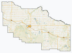
Communities and localities[]
|
The following urban municipalities are surrounded by the MD of Wainwright No. 61:[5]
The following hamlets are located within the MD of Wainwright No. 61:[5] |
The following localities are located within the MD of Wainwright No. 61:[6]
|
See also[]
References[]
- ^ Alberta Municipal Affairs: Municipal Officials Search
- ^ Jump up to: a b c "Population and dwelling counts, for Canada, provinces and territories, and census subdivisions (municipalities), 2016 and 2011 censuses – 100% data (Alberta)". Statistics Canada. February 8, 2017. Retrieved February 8, 2017.
- ^ "Population and dwelling counts, for Canada, provinces and territories, and census subdivisions (municipalities), 2011 and 2006 censuses (Alberta)". Statistics Canada. February 8, 2012. Retrieved February 8, 2012.
- ^ "Alberta 2009 Official Population List" (PDF). Alberta Municipal Affairs. September 15, 2009. Retrieved September 12, 2010.
- ^ Jump up to: a b "Specialized and Rural Municipalities and Their Communities" (PDF). Alberta Municipal Affairs. 2012-03-01. Archived from the original (PDF) on 2012-04-09. Retrieved 2012-08-12.
- ^ "Standard Geographical Classification (SGC) 2006, Economic Regions: 4807049 - Wainwright No. 61, geographical codes and localities, 2006". Statistics Canada. 2010-03-05. Retrieved 2012-08-12.
External links[]
| show Places adjacent to Municipal District of Wainwright No. 61 |
|---|
| show Authority control |
|---|
- Municipal District of Wainwright No. 61
- Municipal districts in Alberta