National Register of Historic Places listings in Buffalo County, South Dakota

Location of Buffalo County in South Dakota
This is a list of the National Register of Historic Places listings in Buffalo County, South Dakota.
This is intended to be a complete list of the properties and districts on the National Register of Historic Places in Buffalo County, South Dakota, United States. The locations of National Register properties and districts for which the latitude and longitude coordinates are included below, may be seen in a map.[1]
There are 7 properties and districts listed on the National Register in the county, including 2 National Historic Landmarks. Another property was once listed but has been removed.
- This National Park Service list is complete through NPS recent listings posted February 11, 2022.[2]
Current listings[]
| [3] | Name on the Register[4] | Image | Date listed[5] | Location | City or town | Description |
|---|---|---|---|---|---|---|
| 1 | Bank of Buffalo County | February 12, 1999 (#99000206) |
Main St. 44°01′59″N 98°59′11″W / 44.033056°N 98.986389°W | Gann Valley | ||
| 2 | Crow Creek Site | 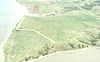 |
October 15, 1966 (#66000710) |
Address Restricted | Chamberlain | |
| 3 | Duncan Church | February 12, 1999 (#99000207) |
Southwest of Crow Creek, 2 miles south of the county line 44°10′50″N 99°04′09″W / 44.180556°N 99.069167°W | Gann Valley | ||
| 4 | August 14, 1986 (#86002738) |
Address Restricted | Fort Thompson | |||
| 5 | Fort Thompson Mounds | 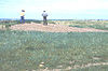 |
October 15, 1966 (#66000711) |
Address Restricted | Fort Thompson | a National Historic Landmark District |
| 6 | August 24, 2018 (#100002808) |
22182 361st Ave. 44°01′31″N 98°58′00″W / 44.0252°N 98.9667°W | Gann Valley vicinity | |||
| 7 |  |
June 2, 2003 (#03000505) |
Address Restricted | Fort Thompson |

Former listing[]
| [3] | Name on the Register | Image | Date listed | Date removed | Location | City or town | Description |
|---|---|---|---|---|---|---|---|
| 1 | June 27, 2002 (#02000707) | March 26, 2008 | 100 Main Street | Gann Valley |
See also[]
| Wikimedia Commons has media related to National Register of Historic Places in Buffalo County, South Dakota. |
- List of National Historic Landmarks in South Dakota
- National Register of Historic Places listings in South Dakota
References[]
- ^ The latitude and longitude information provided in this table was derived originally from the National Register Information System, which has been found to be fairly accurate for about 99% of listings. Some locations in this table may have been corrected to current GPS standards.
- ^ National Park Service, United States Department of the Interior, "National Register of Historic Places: Weekly List Actions", retrieved February 11, 2022.
- ^ a b Numbers represent an alphabetical ordering by significant words. Various colorings, defined here, differentiate National Historic Landmarks and historic districts from other NRHP buildings, structures, sites or objects.
- ^ "National Register Information System". National Register of Historic Places. National Park Service. April 24, 2008.
- ^ The eight-digit number below each date is the number assigned to each location in the National Register Information System database, which can be viewed by clicking the number.
| Topics |  | |
|---|---|---|
| Lists by county |
| |
| Other lists | ||
| ||
| Topics | |
|---|---|
| Lists by state |
|
| Lists by insular areas | |
| Lists by associated state | |
| Other areas | |
| Related | |
| |
Municipalities and communities of Buffalo County, South Dakota, United States | ||
|---|---|---|
| CDPs | 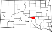 | |
| Township | ||
| Unorganized territories | ||
| Indian reservation | ||
| Footnotes | ‡This populated place also has portions in an adjacent county or counties | |
| ||
Categories:
- Buffalo County, South Dakota
- Lists of National Register of Historic Places in South Dakota by county
- National Register of Historic Places in Buffalo County, South Dakota