National Register of Historic Places listings in Spink County, South Dakota

From Wikipedia, the free encyclopedia
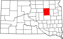
Location of Spink County in South Dakota

This is a list of the National Register of Historic Places listings in Spink County, South Dakota.

This is intended to be a complete list of the properties and districts on the National Register of Historic Places in Spink County, South Dakota, United States. The locations of National Register properties and districts for which the latitude and longitude coordinates are included below, may be seen in a map.[1]

There are 27 properties and districts listed on the National Register in the county. Two previously listed sites have been removed.

This National Park Service list is complete through NPS recent listings posted February 11, 2022.[2]
Map all coordinates using: OpenStreetMap 
Download coordinates as: KML

Current listings[]

[3] Name on the Register[4] Image Date listed[5] Location City or town Description
1
William F. Bruell House
October 12, 2000
(#00001222)
Address Restricted
Redfield Queen Anne-style house built in 1902, designed by Sedgwick & Saxton.[6]
2
Chicago and Northwestern Depot
November 21, 1980
(#80003732)
U.S. Route 212
44°52′30″N 98°31′19″W / 44.875°N 98.521944°W / 44.875; -98.521944 (Chicago and Northwestern Depot)
Redfield
3 November 18, 2019
(#100004622)
Humphrey Dr. to 2nd St.
44°53′43″N 98°06′06″W / 44.8952°N 98.1018°W / 44.8952; -98.1018 (Doland Commercial Historic District)
Doland
4 First Congregational Church September 14, 1979
(#79002407)
Oak and 2nd Sts.
45°03′01″N 98°05′46″W / 45.050278°N 98.096111°W / 45.050278; -98.096111 (First Congregational Church)
Turton
5 February 26, 1982
(#82003940)
Southwest of Turton
44°57′20″N 98°13′40″W / 44.955556°N 98.227778°W / 44.955556; -98.227778 (Harlow Farmstead)
Frankfort
6 Markham Farmstead September 13, 1990
(#90000958)
Junction of County Roads 4 and 7
45°12′01″N 98°12′30″W / 45.200278°N 98.208333°W / 45.200278; -98.208333 (Markham Farmstead)
Conde
7 Norbeck-Nicholson Carriage House January 21, 2015
(#14001190)
910 E. 2nd St.
44°52′24″N 98°30′55″W / 44.873301°N 98.515212°W / 44.873301; -98.515212 (Norbeck-Nicholson Carriage House)
Redfield
8 Old Spink Colony June 30, 1982
(#82003941)
On the James River
44°44′49″N 98°17′35″W / 44.746944°N 98.293056°W / 44.746944; -98.293056 (Old Spink Colony)
Frankfort
9
Edbert and Josie Opitz House
December 2, 1998
(#98001408)
204 E. 2nd St.
44°52′50″N 98°30′54″W / 44.880556°N 98.515°W / 44.880556; -98.515 (Edbert and Josie Opitz House)
Redfield
10 Redfield Carnegie Library
Redfield Carnegie Library
February 17, 1978
(#78002568)
5 E. 5th Ave.
44°52′34″N 98°31′19″W / 44.876111°N 98.521944°W / 44.876111; -98.521944 (Redfield Carnegie Library)
Redfield
11 Old Redfield City Hall
Old Redfield City Hall
February 21, 1997
(#97000146)
517 N. Main St.
44°52′07″N 98°30′32″W / 44.868611°N 98.508889°W / 44.868611; -98.508889 (Old Redfield City Hall)
Redfield
12 Redfield Light Plant and Fire Station March 21, 1978
(#78002569)
614 1st St., E.
44°52′35″N 98°31′01″W / 44.876389°N 98.516944°W / 44.876389; -98.516944 (Redfield Light Plant and Fire Station)
Redfield
13 Salem Church September 3, 1997
(#97001107)
208 Ohio St.
44°44′13″N 98°30′27″W / 44.736944°N 98.5075°W / 44.736944; -98.5075 (Salem Church)
Tulare
14
Site 39SP2
February 1, 1984
(#84003408)
Address Restricted
Frankfort
15
Site 39SP4
June 8, 2005
(#05000590)
Address Restricted
Tulare
16
Site 39SP12
February 1, 1984
(#84003403)
Address Restricted
Ashton
17
Site 39SP19
February 1, 1984
(#84003405)
Address Restricted
Spink Colony
18
Site 39SP37
February 1, 1984
(#84003411)
Address Restricted
Crandon
19
Site 39SP46
February 1, 1984
(#84003413)
Address Restricted
Crandon
20 December 9, 1993
(#93001313)
Local road over Wolf Creek
44°41′54″N 98°41′11″W / 44.698333°N 98.686389°W / 44.698333; -98.686389 (South Dakota Dept. of Transportation Bridge No. 58-010-376)
Tulare Bridge replaced between 2009 and 2011[7]
21 December 9, 1993
(#93001314)
Local road over Turtle Creek
44°39′46″N 98°39′51″W / 44.662778°N 98.664167°W / 44.662778; -98.664167 (South Dakota Dept. of Transportation Bridge No. 58-021-400)
Tulare Bridge replaced between 2010 and 2012[8]
22 December 9, 1993
(#93001315)
Local road over Turtle Creek
44°42′24″N 98°39′19″W / 44.706667°N 98.655278°W / 44.706667; -98.655278 (South Dakota Dept. of Transportation Bridge No. 58-025-370)
Tulare
23 December 9, 1993
(#93001316)
Local road over Turtle Creek
44°51′02″N 98°34′54″W / 44.850556°N 98.581667°W / 44.850556; -98.581667 (South Dakota Dept. of Transportation Bridge No. 58-062-270)
Redfield
24 December 9, 1993
(#93001318)
Local road over the James River
45°54′38″N 98°28′19″W / 45.910683°N 98.471984°W / 45.910683; -98.471984 (South Dakota Dept. of Transportation Bridge No. 58-120-231)
Redfield
25 December 9, 1993
(#93001319)
Local road over the James River
44°55′13″N 98°25′54″W / 44.9203719°N 98.4316032°W / 44.9203719; -98.4316032 (South Dakota Dept. of Transportation Bridge No. 58-140-224)
Redfield
26 December 9, 1993
(#93001320)
Local road over the James River
44°43′11″N 98°15′59″W / 44.719722°N 98.266389°W / 44.719722; -98.266389 (South Dakota Dept. of Transportation Bridge No. 58-218-360)
Frankfort
27 Spink County Courthouse
Spink County Courthouse
November 8, 2001
(#01001219)
210 E. 7th Ave.
44°52′31″N 98°30′51″W / 44.875278°N 98.514167°W / 44.875278; -98.514167 (Spink County Courthouse)
Redfield

Formerly listed[]

[3] Name on the Register Image Date listedDate removed Location City or town Description
1 June 17, 1982
(#82003939)
July 17, 2009 Northeastern corner of 2nd Ave. and 2nd St.
44°59′39″N 98°29′55″W / 44.9942°N 98.4986°W / 44.9942; -98.4986 (Ashton Methodist Church)
Ashton
2 December 9, 1993
(#93001317)
March 16, 2008 Local road over Snake Creek
Ashton
3 January 3, 1978
(#78002567)
June 26, 1989 SE of Ashton on Snake Creek
Ashton vicinity

See also[]

References[]

  1. ^ The latitude and longitude information provided in this table was derived originally from the National Register Information System, which has been found to be fairly accurate for about 99% of listings. Some locations in this table may have been corrected to current GPS standards.
  2. ^ National Park Service, United States Department of the Interior, "National Register of Historic Places: Weekly List Actions", retrieved February 11, 2022.
  3. ^ a b Numbers represent an alphabetical ordering by significant words. Various colorings, defined here, differentiate National Historic Landmarks and historic districts from other NRHP buildings, structures, sites or objects.
  4. ^ "National Register Information System". National Register of Historic Places. National Park Service. April 24, 2008.
  5. ^ The eight-digit number below each date is the number assigned to each location in the National Register Information System database, which can be viewed by clicking the number.
  6. ^ Kaija Swisher (Jan 24, 2014). "Bruell house". Black Hills Pioneer.
  7. ^ "BridgeReports.com - 375TH AVE over WOLF CK, Spink County, South Dakota". uglybridges.com.
  8. ^ "BridgeReports.com - 188TH ST over TURTLE CK, Spink County, South Dakota". uglybridges.com.
Retrieved from ""