National Register of Historic Places listings in Carlisle County, Kentucky

Location of Carlisle County in Kentucky
This is a list of the National Register of Historic Places listings in Carlisle County, Kentucky.
It is intended to be a complete list of the properties on the National Register of Historic Places in Carlisle County, Kentucky, United States. The locations of National Register properties for which the latitude and longitude coordinates are included below, may be seen in a map.[1]
There are 5 properties listed on the National Register in the county.
This National Park Service list is complete through NPS recent listings posted February 18, 2022.[2]
Current listings[]
| [3] | Name on the Register | Image | Date listed[4] | Location | City or town | Description |
|---|---|---|---|---|---|---|
| 1 | Illinois Central Railroad Station and Freight Depot |  |
July 19, 1976 (#76000860) |
Front St. 36°52′21″N 89°00′43″W / 36.8725°N 89.011944°W | Bardwell | Since destroyed |
| 2 | Marshall Site (15CE27) | 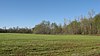 |
November 14, 1985 (#85002818) |
Mississippi River bluff off , northwest of Bardwell[5] 36°54′00″N 89°05′04″W / 36.900000°N 89.084444°W | Bardwell | |
| 3 | Neville-Patterson-Lamkin House | June 16, 1976 (#76000859) |
Kentucky Route 80 36°47′21″N 89°00′40″W / 36.789167°N 89.011111°W | Arlington | ||
| 4 | George W. Stone House | March 17, 1994 (#94000223) |
Kentucky Route 80 36°47′57″N 88°53′48″W / 36.799167°N 88.896667°W | Milburn | ||
| 5 | Turk Site (15CE6) |  |
November 14, 1985 (#85002822) |
Mississippi River bluff off , northwest of Bardwell[5] 36°53′41″N 89°05′07″W / 36.894722°N 89.085278°W | Bardwell |

See also[]
| Wikimedia Commons has media related to National Register of Historic Places in Carlisle County, Kentucky. |
- List of National Historic Landmarks in Kentucky
- National Register of Historic Places listings in Kentucky
References[]
- ^ The latitude and longitude information provided in this table was derived originally from the National Register Information System, which has been found to be fairly accurate for about 99% of listings. Some locations in this table may have been corrected to current GPS standards.
- ^ National Park Service, United States Department of the Interior, "National Register of Historic Places: Weekly List Actions", retrieved February 18, 2022.
- ^ Numbers represent an alphabetical ordering by significant words. Various colorings, defined here, differentiate National Historic Landmarks and historic districts from other NRHP buildings, structures, sites or objects.
- ^ The eight-digit number below each date is the number assigned to each location in the National Register Information System database, which can be viewed by clicking the number.
- ^ a b Edging, Richard. "The Vacant Quarter Hypothesis: A Survivor's Story". Missouri Archaeologist 68 Whole Volume: 59-93: 72.
U.S. National Register of Historic Places | |
|---|---|
| Topics |
|
| Lists by state |
|
| Lists by insular areas | |
| Lists by associated state | |
| Other areas | |
| Related | |
| |
Municipalities and communities of Carlisle County, Kentucky, United States | ||
|---|---|---|
County seat: Bardwell | ||
| Cities |
|  |
| CDP | ||
| Other community |
| |
| ||
Categories:
- Lists of National Register of Historic Places in Kentucky by county
- National Register of Historic Places in Carlisle County, Kentucky