National Register of Historic Places listings in McLean County, Kentucky

Location of McLean County in Kentucky
This is a list of the National Register of Historic Places listings in McLean County, Kentucky.
It is intended to be a complete list of the properties on the National Register of Historic Places in McLean County, Kentucky, United States. The locations of National Register properties for which the latitude and longitude coordinates are included below, may be seen in a map.[1]
There are 9 properties listed on the National Register in the county, of which 6 are part of a National Historic Landmark spread across multiple counties.
This National Park Service list is complete through NPS recent listings posted February 18, 2022.[2]
Current listings[]
| [3] | Name on the Register | Image | Date listed[4] | Location | City or town | Description |
|---|---|---|---|---|---|---|
| 1 |  |
March 15, 1982 (#82002738) |
Left bank of the Green River, 1.5 miles (2.4 km) below the mouth of the Rough River[5]: 4 37°29′08″N 87°09′52″W / 37.485556°N 87.164444°W | Livermore | ||
| 2 | 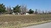 |
April 1, 1986 (#86000648) |
Left bank of the Green River immediately above Rumsey[5]: 4 37°31′48″N 87°15′05″W / 37.530000°N 87.251389°W | Rumsey | Part of the Green River Shell Middens Archeological District National Historic Landmark[6]: 21 | |
| 3 | April 1, 1986 (#86000649) |
Above the right bank of the Rough River, 1.5 miles (2.4 km) east of Livermore[5]: 4 37°29′03″N 87°06′21″W / 37.484167°N 87.105833°W | Livermore | Part of the Green River Shell Middens Archeological District National Historic Landmark[6]: 22 | ||
| 4 | 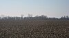 |
April 1, 1986 (#86000650) |
Left bank of the Green River, 4 miles (6.4 km) below Calhoun[5]: 4 37°32′36″N 87°18′21″W / 37.543333°N 87.305833°W | Calhoun | Part of the Green River Shell Middens Archeological District National Historic Landmark[6]: 20 | |
| 5 | Battle of Sacramento Battlefield |  |
March 24, 1998 (#97000875) |
Junction of Kentucky Routes 81 and 85 37°25′10″N 87°15′42″W / 37.419444°N 87.261667°W | Sacramento | |
| 6 |  |
April 1, 1986 (#86000651) |
Southern bank of the Green River across from the mouth of the Rough River[5]: 31 37°28′57″N 87°08′03″W / 37.482500°N 87.134167°W | Livermore | Part of the Green River Shell Middens Archeological District National Historic Landmark[6]: 19 | |
| 7 |  |
April 1, 1986 (#86000652) |
Left bank of the Green River, 1 mile (1.6 km) above Livermore[7] 37°28′26″N 87°07′27″W / 37.473889°N 87.124167°W | Kirtley | Part of the Green River Shell Middens Archeological District National Historic Landmark[6]: 23 | |
| 8 | April 1, 1986 (#86000653) |
Along the Green River off Kentucky Route 256, west of Calhoun[5]: 4 37°33′36″N 87°22′00″W / 37.560000°N 87.366667°W | Ashbyburg | Part of the Green River Shell Middens Archeological District National Historic Landmark.[6]: 18 | ||
| 9 | Griffith-Franklin House | 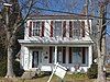 |
July 7, 1975 (#75002061) |
207 W. 2nd St. 37°32′13″N 87°15′38″W / 37.536944°N 87.260556°W | Calhoun |

See also[]
| Wikimedia Commons has media related to National Register of Historic Places in McLean County, Kentucky. |
- List of National Historic Landmarks in Kentucky
- National Register of Historic Places listings in Kentucky
References[]
- ^ The latitude and longitude information provided in this table was derived originally from the National Register Information System, which has been found to be fairly accurate for about 99% of listings. Some locations in this table may have been corrected to current GPS standards.
- ^ National Park Service, United States Department of the Interior, "National Register of Historic Places: Weekly List Actions", retrieved February 18, 2022.
- ^ Numbers represent an alphabetical ordering by significant words. Various colorings, defined here, differentiate National Historic Landmarks and historic districts from other NRHP buildings, structures, sites or objects.
- ^ The eight-digit number below each date is the number assigned to each location in the National Register Information System database, which can be viewed by clicking the number.
- ^ a b c d e f Webb, William S., and William G. Haag. "Archaic Sites in McLean County, Kentucky". University of Kentucky Reports in Anthropology 7.1 (1947): 1-46.
- ^ a b c d e f National Historic Landmark Nomination: Green River Shell Middens. National Park Service: 1994-05-05.
- ^ Claassen, Cheryl. Feasting with Shellfish in the Southern Ohio Valley: Archaic Sacred Sites and Rituals. Knoxville: U of Tennessee P, 2010, 41.
Municipalities and communities of McLean County, Kentucky, United States | ||
|---|---|---|
County seat: Calhoun | ||
| Cities |
|  |
| CDP | ||
| Unincorporated communities | ||
| ||
Categories:
- Lists of National Register of Historic Places in Kentucky by county
- National Register of Historic Places in McLean County, Kentucky