Paars
From Wikipedia, the free encyclopedia
For the political term, see Purple (government).
show This article may be expanded with text translated from the corresponding article in French. (December 2008) Click [show] for important translation instructions.
|
Commune in Hauts-de-France, France
Paars | |
|---|---|
Commune | |
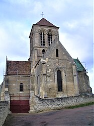 The church of Paars | |
 Paars  Paars | |
Coordinates:  49°19′45″N 3°36′05″E / 49.3292°N 3.6014°E / 49.3292; 3.6014Coordinates: 49°19′45″N 3°36′05″E / 49.3292°N 3.6014°E / 49.3292; 3.6014 49°19′45″N 3°36′05″E / 49.3292°N 3.6014°E / 49.3292; 3.6014Coordinates: 49°19′45″N 3°36′05″E / 49.3292°N 3.6014°E / 49.3292; 3.6014 | |
| Country | France |
| Region | Hauts-de-France |
| Department | Aisne |
| Arrondissement | Soissons |
| Canton | Fère-en-Tardenois |
| Intercommunality | |
| Government | |
| • Mayor (2020–2026) | Thierry Vallée[1] |
| Area 1 | 5.15 km2 (1.99 sq mi) |
| Population (Jan. 2018)[2] | 320 |
| • Density | 62/km2 (160/sq mi) |
| Time zone | UTC+01:00 (CET) |
| • Summer (DST) | UTC+02:00 (CEST) |
| INSEE/Postal code | 02581 /02220 |
| Elevation | 54–169 m (177–554 ft) (avg. 90 m or 300 ft) |
| 1 French Land Register data, which excludes lakes, ponds, glaciers > 1 km2 (0.386 sq mi or 247 acres) and river estuaries. | |

Paars is a commune in the Aisne department in Hauts-de-France in northern France.
Population[]
| Year | Pop. | ±% |
|---|---|---|
| 2006 | 252 | — |
| 2007 | 259 | +2.8% |
| 2008 | 263 | +1.5% |
| 2009 | 273 | +3.8% |
| 2010 | 284 | +4.0% |
| 2011 | 294 | +3.5% |
| 2012 | 297 | +1.0% |
| 2013 | 297 | +0.0% |
| 2014 | 300 | +1.0% |
| 2015 | 303 | +1.0% |
| 2016 | 306 | +1.0% |
See also[]
References[]
- ^ "Répertoire national des élus: les maires". data.gouv.fr, Plateforme ouverte des données publiques françaises (in French). 2 December 2020.
- ^ "Populations légales 2018". INSEE. 28 December 2020.
| Wikimedia Commons has media related to Paars. |
show
| |
|---|---|
| Prefecture |
|
| Subprefectures |
|
| Other |
|
This Soissons arrondissement geographical article is a stub. You can help Wikipedia by . |
- v
- t
Retrieved from ""
Categories:
- Communes of Aisne
- Soissons arrondissement geography stubs
Hidden categories:
- CS1 French-language sources (fr)
- Articles to be expanded from December 2008
- All articles to be expanded
- Geography articles needing translation from French Wikipedia
- Articles with short description
- Short description is different from Wikidata
- Infobox mapframe without OSM relation ID on Wikidata
- Coordinates on Wikidata
- Pages using infobox settlement with image map1 but not image map
- Commons category link from Wikidata
- AC with 0 elements
- Aisne communes articles needing translation from French Wikipedia
- All stub articles
- Pages using the Kartographer extension