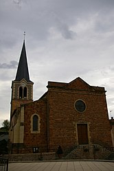
Perreux, Loire
Perreux | |
|---|---|
Commune | |
 | |
 Coat of arms | |
show Location of Perreux | |
 Perreux | |
| Coordinates: 46°02′20″N 4°07′23″E / 46.0389°N 4.1231°ECoordinates: 46°02′20″N 4°07′23″E / 46.0389°N 4.1231°E | |
| Country | France |
| Region | Auvergne-Rhône-Alpes |
| Department | Loire |
| Arrondissement | Roanne |
| Canton | Le Coteau |
| Intercommunality | Roannais Agglomération |
| Government | |
| • Mayor (2020–2026) | Jean Yves Boire |
| Area 1 | 41.35 km2 (15.97 sq mi) |
| Population (Jan. 2018)[1] | 2,110 |
| • Density | 51/km2 (130/sq mi) |
| Time zone | UTC+01:00 (CET) |
| • Summer (DST) | UTC+02:00 (CEST) |
| INSEE/Postal code | 42170 /42120 |
| Elevation | 255–436 m (837–1,430 ft) (avg. 320 m or 1,050 ft) |
| 1 French Land Register data, which excludes lakes, ponds, glaciers > 1 km2 (0.386 sq mi or 247 acres) and river estuaries. | |


Perreux (French pronunciation: [pɛʁø]) is a commune in the Loire department in central France.
Population[]
|
|
See also[]
References[]
- ^ "Populations légales 2018". INSEE. 28 December 2020.
| Wikimedia Commons has media related to Perreux (Loire). |
| show Authority control |
|---|
This Loire geographical article is a stub. You can help Wikipedia by . |
Categories:
- Communes of Loire (department)
- Loire geography stubs