Picture Butte
Picture Butte | |
|---|---|
Town | |
| Town of Picture Butte | |
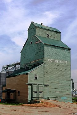 Former Alberta Wheat Pool elevator along the disused CPR tracks. | |
| Nickname(s): Livestock Feeding Capital of Canada | |
 Picture Butte Location of Picture Butte in Alberta | |
| Coordinates: 49°52′23″N 112°46′48″W / 49.87306°N 112.78000°WCoordinates: 49°52′23″N 112°46′48″W / 49.87306°N 112.78000°W | |
| Country | Canada |
| Province | Alberta |
| Region | Southern Alberta |
| Census division | 2 |
| Municipal district | Lethbridge County |
| Incorporated[1] | |
| • Village | February 4, 1943 |
| • Town | January 1, 1960 |
| Government | |
| • Mayor | Cathy Moore |
| • Governing body | Picture Butte Town Council |
| Area (2016)[3] | |
| • Land | 2.85 km2 (1.10 sq mi) |
| Elevation | 905 m (2,969 ft) |
| Population (2016)[3] | |
| • Total | 1,810 |
| • Density | 635.1/km2 (1,645/sq mi) |
| Time zone | UTC−7 (MST) |
| • Summer (DST) | UTC−6 (MDT) |
| Postal code span | T0K 1V0 |
| Highways | Highway 25 Highway 519 |
| Waterway | Oldman River |
| Website | Official website |

Picture Butte is a town in southern Alberta, Canada. It is located 27 km (17 mi) north of the city of Lethbridge. It claims the title of "Livestock Feeding Capital of Canada."
History[]
Picture Butte received its name from a prominence southeast of town. By 1947, however, the prominence's soil had been reworked and used for street improvements, highway construction and a dyke on the shore of the Picture Butte Lake Reservoir. The prominence no longer exists.
Homesteading in the area began in the early 20th century. The building of the Lethbridge Northern Irrigation System in 1923 and the CPR rail line in 1925 stimulated an influx of settlers. The first post office opened in 1925.[5]
In 1943, Picture Butte became a village, and it attained town status in 1961 with a population of 978.
The Canadian Sugar Factory closed in 1978 and resulted in the loss of tax revenues and employment opportunities to the town. Industrial activity consists of small service, warehousing and wholesaling industries.
The town annexed approximately 165 acres (0.67 km2) in 1991, significantly changing the town's boundary since the general municipal plan of 1980.[6]
Demographics[]
In the 2016 Census of Population conducted by Statistics Canada, the Town of Picture Butte recorded a population of 1,810 living in 672 of its 706 total private dwellings, a 9.7% change from its 2011 population of 1,650. With a land area of 2.85 km2 (1.10 sq mi), it had a population density of 635.1/km2 (1,644.9/sq mi) in 2016.[3]
In the 2011 Census, the Town of Picture Butte had a population of 1,650 living in 625 of its 660 total dwellings, a 3.6% change from its 2006 population of 1,592. With a land area of 2.9 km2 (1.1 sq mi), it had a population density of 569.0/km2 (1,473.6/sq mi) in 2011.[7]
The population of the Town of Picture Butte according to its 2010 municipal census is 1,658.[8]
| Year | Pop. | ±% |
|---|---|---|
| 1946 | 689 | — |
| 1951 | 865 | +25.5% |
| 1971 | 1,062 | +22.8% |
| 1976 | 1,177 | +10.8% |
| 1981 | 1,393 | +18.4% |
| 1986 | 1,576 | +13.1% |
| 1991 | 1,559 | −1.1% |
| 1996 | 1,669 | +7.1% |
| 2001 | 1,701 | +1.9% |
| 2006 | 1,592 | −6.4% |
| 2011 | 1,650 | +3.6% |
| 2016 | 1,810 | +9.7% |
| Sources: [1] [2] [3] [4] [5] [6] [7] [8] [9] [10] | ||
Education[]
Picture Butte is part of the Palliser Regional School Division #26, and also part of the Holy Spirit Roman Catholic Separate School District #4.
The following schools are located in Picture Butte:
- Dorothy Dalgliesh Elementary School [K-6]
- St. Catherine's School [K-9]
- Picture Butte High School [7-12]
Notable people[]
- Hal Anderson, radio personality
See also[]
References[]
- ^ "Location and History Profile: Town of Picture Butte" (PDF). Alberta Municipal Affairs. October 7, 2016. p. 477. Retrieved October 13, 2016.
- ^ "Municipal Officials Search". Alberta Municipal Affairs. May 9, 2019. Retrieved October 1, 2021.
- ^ a b c "Population and dwelling counts, for Canada, provinces and territories, and census subdivisions (municipalities), 2016 and 2011 censuses – 100% data (Alberta)". Statistics Canada. February 8, 2017. Retrieved February 8, 2017.
- ^ "Alberta Private Sewage Systems 2009 Standard of Practice Handbook: Appendix A.3 Alberta Design Data (A.3.A. Alberta Climate Design Data by Town)" (PDF) (PDF). Safety Codes Council. January 2012. pp. 212–215 (PDF pages 226–229). Retrieved October 9, 2013.
- ^ Coyote Flats Historical Society (1967). Coyote Flats : historical review, 1905-1965. Volume 1. Lethbridge: Southern Printing. p. 275.
- ^ "Town of Picture Butte Municipal Development Plan" (PDF). Oldman River Regional Services Commission. March 2004. Archived from the original (PDF) on 2007-09-28. Retrieved 2007-08-27.
- ^ "Population and dwelling counts, for Canada, provinces and territories, and census subdivisions (municipalities), 2011 and 2006 censuses (Alberta)". Statistics Canada. 2012-02-08. Retrieved 2012-02-08.
- ^ "2010 Official Population List" (PDF). Alberta Municipal Affairs. 2010-09-15. Retrieved 2011-01-19.
External links[]
Places adjacent to Picture Butte | |
|---|---|
- 1943 establishments in Alberta
- Lethbridge County
- Towns in Alberta