Pleak, Texas
Pleak, Texas | |
|---|---|
| Motto(s): "A small village with big expectations"[1] | |
 Location of Pleak, Texas | |
 | |
| Coordinates: 29°29′3″N 95°48′36″W / 29.48417°N 95.81000°WCoordinates: 29°29′3″N 95°48′36″W / 29.48417°N 95.81000°W | |
| Country | United States |
| State | Texas |
| County | Fort Bend |
| Area | |
| • Total | 1.85 sq mi (4.79 km2) |
| • Land | 1.82 sq mi (4.73 km2) |
| • Water | 0.03 sq mi (0.07 km2) |
| Elevation | 85 ft (26 m) |
| Population (2010) | |
| • Total | 1,044 |
| • Estimate (2019)[3] | 1,675 |
| • Density | 917.81/sq mi (354.43/km2) |
| Time zone | UTC-6 (Central (CST)) |
| • Summer (DST) | UTC-5 (CDT) |
| ZIP code | 77469 |
| Area code(s) | 281 |
| FIPS code | 48-58088[4] |
| GNIS feature ID | 1378879[5] |
| Website | villageofpleak |

Pleak is a village in Fort Bend County, Texas, United States, within the Houston–Sugar Land–Baytown metropolitan area. It is on Texas State Highway 36 south of Rosenberg. Its population was 1,044 at the 2010 census.[6]
Geography[]
Pleak is south of the center of Fort Bend County, at 29°29'3" North, 95°48'36" West (29.484144, -95.810087).[7] From Pleak, Texas Highway 36 leads 4.5 miles (7.2 km) north to the center of Rosenberg and 8 miles (13 km) south to Needville.
According to the United States Census Bureau, Pleak has a total area of 2.0 square miles (5.1 km2), of which 0.035 square miles (0.09 km2), or 1.86%, is water.[6]
Demographics[]
| Historical population | |||
|---|---|---|---|
| Census | Pop. | %± | |
| 1980 | 619 | — | |
| 1990 | 746 | 20.5% | |
| 2000 | 947 | 26.9% | |
| 2010 | 1,044 | 10.2% | |
| 2019 (est.) | 1,675 | [3] | 60.4% |
| U.S. Decennial Census[8] | |||
As of the 2000 census,[4] 947 people, 318 households and 269 families resided in the village. The population density was 473.8 people per square mile (182.8/km2). There were 325 housing units at an average density of 162.6/sq mi (62.7/km2). The racial makeup of the village was 80.04% White, 4.33% African American, 0.32% Native American, 0.32% Asian, 0.00% Pacific Islander, 13.94% from other races, and 1.06% from two or more races. 29.25% of the population were Hispanic or Latino of any race.
There were 318 households, out of which 38.4% had children under the age of 18 living with them, 71.1% were married couples living together, 8.5% had a female householder with no husband present, and 15.1% were non-families. 12.6% of all households were made up of individuals, and 4.1% had someone living alone who was 65 years of age or older. The average household size was 2.98 and the average family size was 3.22.
In the village, the population was spread out, with 27.1% under the age of 18, 8.3% from 18 to 24, 27.9% from 25 to 44, 28.2% from 45 to 64, and 8.4% who were 65 years of age or older. The median age was 38 years. For every 100 females, there were 98.1 males. For every 100 females age 18 and over, there were 100.0 males.
The median income for a household in the village was $52,188, and the median income for a family was $56,364. Males had a median income of $35,313 versus $25,625 for females. The per capita income for the village was $20,773. 4.5% of the population and 3.4% of families were below the poverty line. 6.0% of those under the age of 18 and 0.0% of those 65 and older were living below the poverty line.
Government and infrastructire[]
Fort Bend County does not have a . serves as the county's which the county contracts with.[9]
Education[]
Pleak is a part of the Lamar Consolidated Independent School District. It is zoned to Meyer Elementary, Navarro Middle School, George Junior High, and B.F. Terry High School.
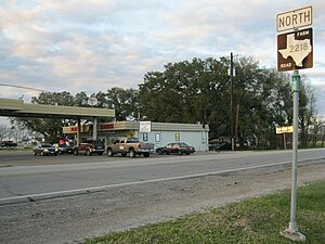
Gallery[]
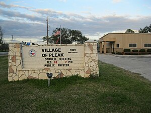
Marquee in front of Pleak City Hall
Pleak Korner business across from City Hall

Highway 36 and FM 2218 intersection in Pleak


References[]
- ^ Village of Pleak official website
- ^ "2019 U.S. Gazetteer Files". United States Census Bureau. Retrieved August 7, 2020.
- ^ a b "Population and Housing Unit Estimates". United States Census Bureau. May 24, 2020. Retrieved May 27, 2020.
- ^ a b "U.S. Census website". United States Census Bureau. Retrieved 2008-01-31.
- ^ "US Board on Geographic Names". United States Geological Survey. 2007-10-25. Retrieved 2008-01-31.
- ^ a b "Geographic Identifiers: 2010 Demographic Profile Data (G001): Pleak village, Texas". U.S. Census Bureau, American Factfinder. Retrieved September 1, 2016.[dead link]
- ^ "US Gazetteer files: 2010, 2000, and 1990". United States Census Bureau. 2011-02-12. Retrieved 2011-04-23.
- ^ "Census of Population and Housing". Census.gov. Retrieved June 4, 2015.
- ^ Knipp, Bethany (2016-11-02). "Fort Bend County lacks hospital district". Community Impact Newspaper. Retrieved 2021-10-18.
External links[]
| Counties |  | |
|---|---|---|
| "Principal" cities |
| |
| Other cities |
For a complete listing, see list of cities and towns in Houston–The Woodlands–Sugar Land MSA | |
| Unincorporated areas | ||
| Bodies of water | ||
Municipalities and communities of Fort Bend County, Texas, United States | ||
|---|---|---|
| Cities |
|  |
| Town | ||
| Villages | ||
| CDPs | ||
| Other communities | ||
| Former communities |
| |
| Ghost town | ||
| Footnotes | ‡This populated place also has portions in an adjacent county or counties ±Former community annexed by Missouri City ^Former community annexed by Sugar Land | |
| ||
Austin (capital) | ||
| Topics | ||
| Society | ||
| Regions |
| |
| Metropolitan areas |
| |
| Counties | ||

- Villages in Fort Bend County, Texas
- Villages in Texas
- Greater Houston