Road signs in Iceland
This article has multiple issues. Please help or discuss these issues on the talk page. (Learn how and when to remove these template messages)
|
Road signs in Iceland conform to the general pattern of those used in most other European countries, with certain design elements borrowed from Danish and Swedish practice. Signs tend to be more sparsely employed than in other European countries, especially in rural areas.
Design[]
Distances and other measurements are displayed in metric units. All text within the main signs and on auxiliary signs is exclusively in Icelandic with very few exceptions.
Colours and shapes[]
Icelandic road signs most closely resemble their Swedish counterparts, with rounded corners and yellow backgrounds. However, there are many differences in detail, especially in the silhouettes used.
Shape and colour are used to indicate the function of signs:
| Type of sign | Shape | Border | Background colour | Text/Symbol |
|---|---|---|---|---|
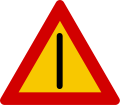
| Warning | Triangular | Red | Yellow | Black |
| Prohibition | Circular | Red | Yellow | Black |
| Mandatory instructions | Circular | White | Blue | White |
| Supplementary | Rectangular | White Red |
Blue Yellow |
White Black |
| Directions, sometimes | Rectangular | Black | Yellow | Black |
| Information | Rectangular | White | Blue | White |
Typeface[]
A version of the Transport typeface employed on road signs in the UK – modified to include accented characters and the Icelandic letters ð (eth) and þ (thorn) – is used on Icelandic road signs.
Gallery[]
A series[]

Dangerous bend to right
Dangerous bend to left

Dangerous bends, first to right

Dangerous bends, first to left
Dangerous intersection

Give way

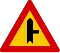
Dangerous intersection where traffic from side road must give way

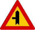
Dangerous intersection where traffic from side road must give way
Dangerous intersection where traffic from side road must give way
Dangerous intersection where traffic from side road must give way
Dangerous intersection where traffic from side road must give way

Dangerous intersection where traffic from side road must give way

Dangerous intersection where traffic from side road must give way

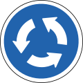
Traffic circle
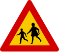
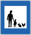
Children

Pedestrians
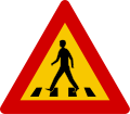
Pedestrian crossing ahead

Horse crossing

Horses

Cattle
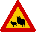
Sheep

Reindeer
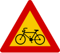
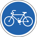
Cyclists
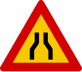
Road narrows on both sides

Road narrows on right hand side

Road narrows on left hand side
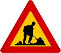
Roadworks

Steep hill downwards

Steep hill upwards
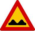
Uneven road
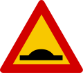
Speed reduction bump

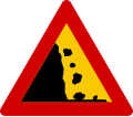
Risk of falling rocks or avalanche from right
Risk of falling rocks or avalanche from left

Loose stones

Traffic lights
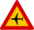
Low-flying aircraft
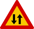
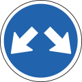
Two-way traffic

Tunnel

Slippery road

High road surface edge

Soft road shoulder

Gust of wind

Quayside

Other danger

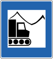
Road grading

Risk of ice on road


B series[]

No vehicles

No entry

No motor vehicles

No motor vehicles except solo motorcycles, scooters or mopeds
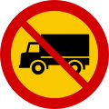
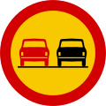
No lorries

No buses or coaches
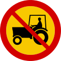
No tractors, off-road vehicles on wheels or motor propelled machinery

No motorcycles

No mopeds

No track-driven cross-country vehicles (snowmobiles / snowscooters)

No bicycles or mopeds
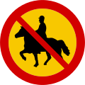
No horse riding
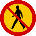
No pedestrians

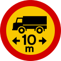
Width limit
Length limit

Height limit
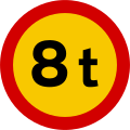
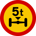
Total weight limit
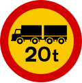
Total weight limit of combination
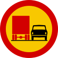
Axle weight limit
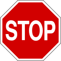
Stop and give way
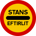
Stop checkpoint

Parking forbidden

Beginning of zone with parking restrictions

End of zone with parking restrictions

Stopping forbidden
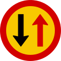
Give way to oncoming traffic
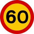
Maximum speed limit in kilometres/hour

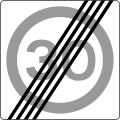
End of maximum speed limit

Beginning of zone with special speed limit
End of zone with special speed limit

No right turn
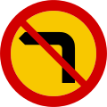
No left turn
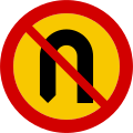
No U-turn
No overtaking
No overtaking by lorries

End of prohibition on overtaking

End of prohibition on overtaking by lorries

End of restrictions
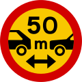
Minimum space between motor vehicles
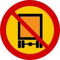
Vehicles carrying dangerous goods prohibited

Transport of water-polluting substances prohibited


C series[]

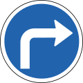
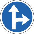
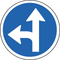
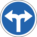
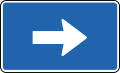
Direction of traffic / proceed in direction indicated by the arrow

Direction of traffic / proceed in direction indicated by the arrow

Direction of traffic / proceed in direction indicated by the arrow
Direction of traffic / proceed in direction indicated by the arrow

Direction of traffic / proceed in direction indicated by the arrow
Direction of traffic / proceed in direction indicated by the arrow
Direction of traffic / proceed in direction indicated by the arrow
Direction of traffic / proceed in direction indicated by the arrow

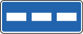
Sign indicating traffic lane
Sign indicating traffic lane
Sign indicating traffic lane
Roundabout traffic
Cycles only

Pedestrian path
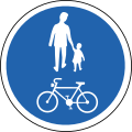
Cyclists and pedestrians only
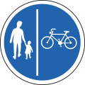
Separate lanes for pedestrians and cyclists
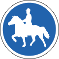
Path for riders


D series[]
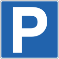
Parking

Covered parking

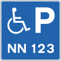
Reserved parking place for disabled person's vehicle
Reserved parking place for specific vehicle used by disabled person
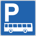
Parking place for buses

Pedestrian crossing

Priority road

End of priority road

Priority over approaching traffic

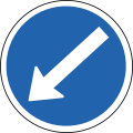
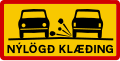
Place for allowing oncoming traffic to pass

One-way traffic

One-way traffic
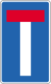
No through road

Taxi rank

Bus stop

Bus terminal

Access for disabled people

Urban area

End of urban area

Traffic integration zone
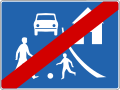
End of traffic integration zone

Pedestrian underpass to the right

Pedestrian underpass to the left

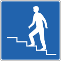
Pedestrian overpass to the right
Pedestrian overpass to the left
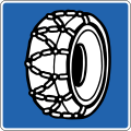
Place for putting snow-chains on tyres

Toll road
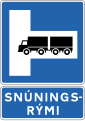
Place for turning on right - Signs indicating large vehicles may be turned around, e.g. in tunnel. Further information is provided on an additional sign below.[1]
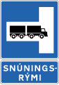
Place for turning on left - Signs indicating large vehicles may be turned around, e.g. in tunnel. Further information is provided on an additional sign below.[2]

Entrance to area

Exit from area
Maximum speeds

Traffic enforcement cameras

Parking place with charging station for electric cars

Parking place for ambulances

Parking place for passenger cars
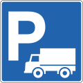
Parking place for goods vehicles

Parking place for bicycles
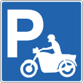
Parking place for motorcycles


E series[]

First aid

Hospital

Police
Pharmacy
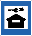
Emergency shelter

Emergency phone

Fire extinguisher

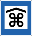
Information
Information booth

Phone

Restroom (water closet)

Outhouse

Water tank discharge

Town centre

Industrial area

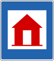
Vacation houses[3]
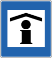
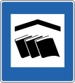
Place of interest (indoors)[3]

Point of interest
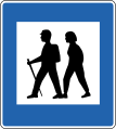
Hiking trail

Picnic area

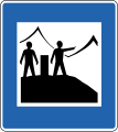
Viewpoint
Viewpoint with information

Rubbish bin

Rubbish container
Radio station/FM Frequency
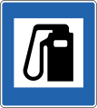
Gasoline

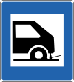
Car mechanic
Tyre repair
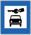
Car rental

Coffee shop
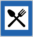
Restaurant
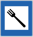
Refreshments in private home
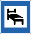
Hotel

Hostel (sleeping bags only)

Youth hostel
Rental cabin

Refuge hut

Campsite
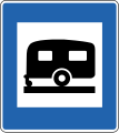
Caravan park
Cooking facilities

Shower
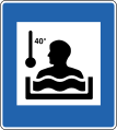
Hot tub

Washing machine

Meeting facilities
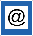
Internet access

Swimming pool

Recreation centre

Sports field

Horse hire[3]
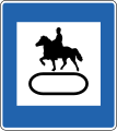
Horse track[3]

Horse stables[3]

Horsecart rental[3]
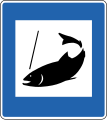
Fishing
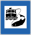
Ocean fishing
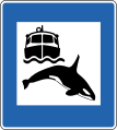
Whale watching

Ski lift
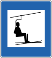
Ski lift with chair
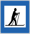
Cross-country ski area
Snowcat trips
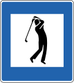
Golf course

Shooting range[3]

Snowmobile rental

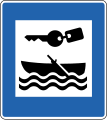
Water scooter rental

Bicycle rental
Boat rental

Water skiing
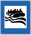
River rafting

Church

Cemetery
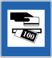
ATM

Bank
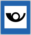
Post office

Tourist shop

Supermarket

Bakery

Food kiosk
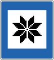
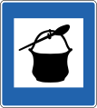
Handicrafts

Greenhouse

Art gallery
Library

Aquarium
Domestic animal park

Dog hotel

Veterinarian
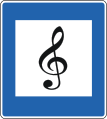
Music performance[3]

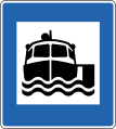
Ferry
Boat trips

Commercial harbour[3]

Airport
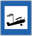
Airstrip


F series[]


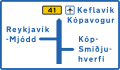


Place direction[3]

Place name (e.g. a river)[3]


unnumbered road[3]
Abandoned farm[3]

County or municipal boundary sign[3]

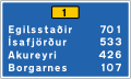
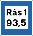
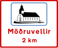
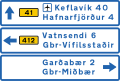
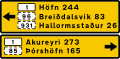
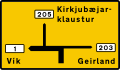
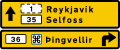
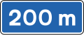
Destination and distance (urban area)[3]
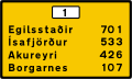
Destination and distance (rural area)[3]


Information on cycling path[3]


G series[]


Lane ends


H series[]
J series[]

When the "road condition" begins

On left

On right

On both sides


Extent of prohibition area[3]

Duration (timing) of prohibition[3]

Parking time limit[4]
Parking places, parallel to road[3]

Parking places, perpendicular to road[3]

Parking places, angled[3]

Handicapped parking[4]


Course of priority road at intersection[3]


Caution, Blind people[4]

Caution, Deaf people[4]

Weight limit[4]

Tow zone[4]
New road surface[4]

Unbridged river crossing[4]
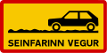
Slow road: Driving is difficult but not impossible for non-4×4 cars[4]
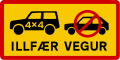
Difficult road: 4×4 car required (these and "TORLEIÐI" are typically preceded with an F, e.g. F35)[4]

Mountain road: Extremely difficult terrain, even in 4×4s[4]

Blind hill[4]
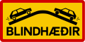
Blind hills[4]

Area with higher accident risk[4]

One-lane road[4]

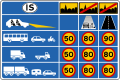
Start of gravel road, slow to 80 km/h (for the best conditions, vary by weather)

One-lane bridge[4]

One-lane tunnel

Stop ahead[4]
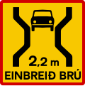
One-lane bridge (with length)[4]

Street running[4]


Old signs[]


References[]
- ^ "Traffic Signs and road markings in Iceland". carrentalss.com. Retrieved 2021-05-13.
- ^ "Traffic Signs and road markings in Iceland". carrentalss.com. Retrieved 2021-05-13.
- ^ a b c d e f g h i j k l m n o p q r s t u v w Karlsson, Guðni (2021). Driving in Iceland. Netökuskólinn ehf. p. 165-172.
- ^ a b c d e f g h i j k l m n o p q r s "Traffic Signs and road markings in Iceland".
- Road signs by country
- Road transport in Iceland