Rural Municipality of Eye Hill No. 382
Eye Hill No. 382 | |
|---|---|
| Rural Municipality of Eye Hill No. 382 | |
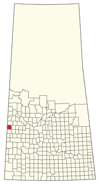 Location of the RM of Eye Hill No. 382 in Saskatchewan | |
| Coordinates: 52°16′52″N 109°46′34″W / 52.281°N 109.776°WCoordinates: 52°16′52″N 109°46′34″W / 52.281°N 109.776°W[4] | |
| Country | Canada |
| Province | Saskatchewan |
| Census division | 13 |
| SARM division | 6 |
| Formed[2] | December 12, 1910 |
| Government | |
| • Reeve | Robert Brost |
| • Governing body | RM of Eye Hill No. 382 Council |
| • Administrator | Jason Pilat |
| • Office location | Macklin |
| Area (2016)[3] | |
| • Land | 798.3 km2 (308.2 sq mi) |
| Population (2016)[3] | |
| • Total | 590 |
| • Density | 0.7/km2 (2/sq mi) |
| Time zone | CST |
| • Summer (DST) | CST |
| Area code(s) | 306 and 639 |

The Rural Municipality of Eye Hill No. 382 (2016 population: 590) is a rural municipality (RM) in the Canadian province of Saskatchewan within Census Division No. 13 and SARM Division No. 6. It is located in the west-central portion of the province adjacent to the Alberta boundary.
History[]
The RM of Eye Hill No. 382 incorporated as a rural municipality on December 12, 1910.[2]
Geography[]
Communities and localities[]
The following urban municipalities are surrounded by the RM.
- Towns
- Villages
- Denzil
The following unincorporated communities are within the RM.
- Special service areas
- Localities
- Evesham (dissolved as a village, August 3, 2000)
Demographics[]
In the 2016 Census of Population conducted by Statistics Canada, the RM of Eye Hill No. 382 recorded a population of 590 living in 210 of its 266 total private dwellings, a -3.9% change from its 2011 population of 614. With a land area of 798.3 km2 (308.2 sq mi), it had a population density of 0.7/km2 (1.9/sq mi) in 2016.[3]
In the 2011 Census of Population, the RM of Eye Hill No. 382 recorded a population of 614, a -5.5% change from its 2006 population of 650. With a land area of 797.67 km2 (307.98 sq mi), it had a population density of 0.8/km2 (2.0/sq mi) in 2011.[7]
Government[]
The RM of Eye Hill No. 382 is governed by an elected municipal council and an appointed administrator that meets on the first Wednesday after the first Monday of every month.[1] The reeve of the RM is Robert Brost while its administrator is Jason Pilat.[1] The RM's office is located in Macklin.[1]
Transportation[]
- Rail[8]
- C.P.R. Outlook Kerrobert Branch—serves Macklin, Primate, Denzil, Salvador, Luseland.
- C.P.R Minnedosa, Saskatoon Edmonton Section—serves Rutland, Senlac, Evesham, Macklin, Hayter, Provost
- Roads
- Highway 14—serves Evesham, and Macklin.
- Highway 17—serves Macklin to Onion Lake
- Highway 317—serves Cactus Lake to Primate
- Highway 31—serves Macklin, Primate, Denzil
- Highway 676—serves Denzil to the north
- —North and south road west of Evesham
References[]
- ^ Jump up to: a b c d "Municipality Details: RM of Eye Hill No. 382". Government of Saskatchewan. Retrieved May 21, 2020.
- ^ Jump up to: a b "Rural Municipality Incorporations (Alphabetical)". Saskatchewan Ministry of Municipal Affairs. Archived from the original on April 21, 2011. Retrieved May 9, 2020.
- ^ Jump up to: a b c "Population and dwelling counts, for Canada, provinces and territories, and census subdivisions (municipalities), 2016 and 2011 censuses – 100% data (Saskatchewan)". Statistics Canada. February 8, 2017. Retrieved May 1, 2020.
- ^ "Pre-packaged CSV files - CGN, Canada/Province/Territory (cgn_sk_csv_eng.zip)". Government of Canada. July 24, 2019. Retrieved May 23, 2020.
- ^ "Saskatchewan Census Population" (PDF). Saskatchewan Bureau of Statistics. Archived from the original (PDF) on September 24, 2015. Retrieved May 9, 2020.
- ^ "Saskatchewan Census Population". Saskatchewan Bureau of Statistics. Retrieved May 9, 2020.
- ^ "Population and dwelling counts, for Canada, provinces and territories, and census subdivisions (municipalities), 2011 and 2006 censuses (Saskatchewan)". Statistics Canada. June 3, 2019. Retrieved May 1, 2020.
- ^ Canadian Maps: January 1925 Waghorn's Guide. Post Offices in Man. Sask. Alta. and West Ontario.
| show Places adjacent to Rural Municipality of Eye Hill No. 382 |
|---|
| show |
|---|
| show Division No. 13, Saskatchewan |
|---|

| Authority control |
|
|---|
- Rural municipalities in Saskatchewan
- Eye Hill No. 382, Saskatchewan
- Division No. 13, Saskatchewan