Sabres, Landes
Sabres | |
|---|---|
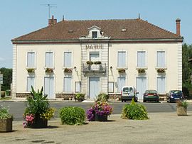 Town hall | |
show Location of Sabres | |
 Sabres | |
| Coordinates: 44°08′56″N 0°44′19″W / 44.1489°N 0.7386°WCoordinates: 44°08′56″N 0°44′19″W / 44.1489°N 0.7386°W | |
| Country | France |
| Region | Nouvelle-Aquitaine |
| Department | Landes |
| Arrondissement | Mont-de-Marsan |
| Canton | Haute Lande Armagnac |
| Government | |
| • Mayor (2020–2026) | Gérard Moreau[1] |
| Area 1 | 160.13 km2 (61.83 sq mi) |
| Population (Jan. 2018)[2] | 1,170 |
| • Density | 7.3/km2 (19/sq mi) |
| Time zone | UTC+01:00 (CET) |
| • Summer (DST) | UTC+02:00 (CEST) |
| INSEE/Postal code | 40246 /40630 |
| Elevation | 58–107 m (190–351 ft) (avg. 76 m or 249 ft) |
| 1 French Land Register data, which excludes lakes, ponds, glaciers > 1 km2 (0.386 sq mi or 247 acres) and river estuaries. | |


Sabres (French pronunciation: [sabʁ]) is a commune in the Landes department in Nouvelle-Aquitaine in southwestern France.
Population[]
|
|
See also[]
References[]
- ^ "Répertoire national des élus: les maires". data.gouv.fr, Plateforme ouverte des données publiques françaises (in French). 2 December 2020.
- ^ "Populations légales 2018". INSEE. 28 December 2020.
| Wikimedia Commons has media related to Sabres (Landes). |
| show Authority control |
|---|
This Landes geographical article is a stub. You can help Wikipedia by . |
Categories:
- Communes of Landes (department)
- Landes (department) geography stubs