Saint-Bandry
From Wikipedia, the free encyclopedia
show This article may be expanded with text translated from the corresponding article in French. (December 2008) Click [show] for important translation instructions.
|
Commune in Hauts-de-France, France
Saint-Bandry | |
|---|---|
Commune | |
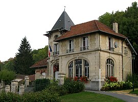 Town hall | |
 Saint-Bandry  Saint-Bandry | |
Coordinates:  49°22′21″N 3°10′04″E / 49.3725°N 3.1678°E / 49.3725; 3.1678Coordinates: 49°22′21″N 3°10′04″E / 49.3725°N 3.1678°E / 49.3725; 3.1678 49°22′21″N 3°10′04″E / 49.3725°N 3.1678°E / 49.3725; 3.1678Coordinates: 49°22′21″N 3°10′04″E / 49.3725°N 3.1678°E / 49.3725; 3.1678 | |
| Country | France |
| Region | Hauts-de-France |
| Department | Aisne |
| Arrondissement | Soissons |
| Canton | Vic-sur-Aisne |
| Government | |
| • Mayor (2020–2026) | Jean-Yves Seznec[1] |
| Area 1 | 6.02 km2 (2.32 sq mi) |
| Population (Jan. 2018)[2] | 264 |
| • Density | 44/km2 (110/sq mi) |
| Time zone | UTC+01:00 (CET) |
| • Summer (DST) | UTC+02:00 (CEST) |
| INSEE/Postal code | 02672 /02290 |
| Elevation | 49–157 m (161–515 ft) (avg. 100 m or 330 ft) |
| 1 French Land Register data, which excludes lakes, ponds, glaciers > 1 km2 (0.386 sq mi or 247 acres) and river estuaries. | |

Saint-Bandry is a commune in the Aisne department in Hauts-de-France in northern France.
Population[]
| Year | Pop. | ±% |
|---|---|---|
| 1962 | 221 | — |
| 1968 | 221 | +0.0% |
| 1975 | 214 | −3.2% |
| 1982 | 200 | −6.5% |
| 1990 | 202 | +1.0% |
| 1999 | 238 | +17.8% |
| 2008 | 223 | −6.3% |
See also[]
References[]
- ^ "Répertoire national des élus: les maires". data.gouv.fr, Plateforme ouverte des données publiques françaises (in French). 2 December 2020.
- ^ "Populations légales 2018". INSEE. 28 December 2020.
| Wikimedia Commons has media related to Saint-Bandry. |
show
| |
|---|---|
| Prefecture |
|
| Subprefectures |
|
| Other |
|
This Soissons arrondissement geographical article is a stub. You can help Wikipedia by . |
- v
- t
Retrieved from ""
Categories:
- Communes of Aisne
- Soissons arrondissement geography stubs
Hidden categories:
- CS1 French-language sources (fr)
- Articles to be expanded from December 2008
- All articles to be expanded
- Geography articles needing translation from French Wikipedia
- Articles with short description
- Short description is different from Wikidata
- Infobox mapframe without OSM relation ID on Wikidata
- Coordinates on Wikidata
- Pages using infobox settlement with image map1 but not image map
- Commons category link from Wikidata
- AC with 0 elements
- Aisne communes articles needing translation from French Wikipedia
- All stub articles
- Pages using the Kartographer extension