Saint-Gildas-de-Rhuys
Saint-Gildas-de-Rhuys
Lokentaz | |
|---|---|
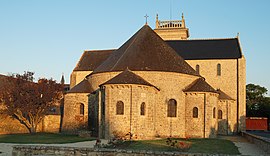 Saint Gildas church | |
 Coat of arms | |
show Location of Saint-Gildas-de-Rhuys | |
 Saint-Gildas-de-Rhuys | |
| Coordinates: 47°30′03″N 2°50′12″W / 47.5008°N 2.8367°WCoordinates: 47°30′03″N 2°50′12″W / 47.5008°N 2.8367°W | |
| Country | France |
| Region | Brittany |
| Department | Morbihan |
| Arrondissement | Vannes |
| Canton | Séné |
| Intercommunality | Golfe du Morbihan - Vannes Agglomération |
| Government | |
| • Mayor (2020–2026) | Alain Layec[1] |
| Area 1 | 15.28 km2 (5.90 sq mi) |
| Population (Jan. 2018)[2] | 1,517 |
| • Density | 99/km2 (260/sq mi) |
| Time zone | UTC+01:00 (CET) |
| • Summer (DST) | UTC+02:00 (CEST) |
| INSEE/Postal code | 56214 /56730 |
| Elevation | 0–42 m (0–138 ft) |
| 1 French Land Register data, which excludes lakes, ponds, glaciers > 1 km2 (0.386 sq mi or 247 acres) and river estuaries. | |


Saint-Gildas-de-Rhuys (Breton: Lokentaz) is a commune in the Morbihan department of Brittany in north-western France.
Its French name refers to Saint Gildas, who founded the on the Rhuys Peninsula in the 6th century. From 920 to 1008, the Norman raids forced the monks to bring the relics of the saint to the abbey of Saint-Gildas of Châteauroux that they founded under the protection of the prince Ebbes of Déols.
Demographics[]
Inhabitants of Saint-Gildas-de-Rhuys are called in French Gildasiens.
Burials[]
- Saint Gildas (d.570)
- Saint Felix of Rhuys (d.1038)
- (also called Saint Gulstan, d.1040)
- Alienor de Bretagne, daughter of John I, Duke of Brittany (d.1249)
- Jeanne de Bretagne, daughter of John IV, Duke of Brittany (d.1388)
See also[]
References[]
- ^ "Maires du Morbihan" (PDF). Préfecture du Morbihan. 7 July 2020.
- ^ "Populations légales 2018". INSEE. 28 December 2020.
External links[]
- Base Mérimée: Search for heritage in the commune, Ministère français de la Culture. (in French)
- Mayors of Morbihan Association (in French)
| Wikimedia Commons has media related to Saint-Gildas-de-Rhuys. |
| show Authority control |
|---|
This Morbihan geographical article is a stub. You can help Wikipedia by . |
Categories:
- Communes of Morbihan
- Morbihan geography stubs