Saint-Hilaire-Saint-Mesmin
Saint-Hilaire-Saint-Mesmin | |
|---|---|
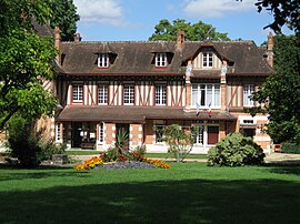 Town hall | |
 Coat of arms | |
show Location of Saint-Hilaire-Saint-Mesmin | |
 Saint-Hilaire-Saint-Mesmin | |
| Coordinates: 47°51′59″N 1°50′09″E / 47.8664°N 1.8358°ECoordinates: 47°51′59″N 1°50′09″E / 47.8664°N 1.8358°E | |
| Country | France |
| Region | Centre-Val de Loire |
| Department | Loiret |
| Arrondissement | Orléans |
| Canton | Olivet |
| Intercommunality | Orléans Métropole |
| Government | |
| • Mayor (2020–2026) | Stéphane Chouin |
| Area 1 | 14.12 km2 (5.45 sq mi) |
| Population (Jan. 2018)[1] | 3,056 |
| • Density | 220/km2 (560/sq mi) |
| Time zone | UTC+01:00 (CET) |
| • Summer (DST) | UTC+02:00 (CEST) |
| INSEE/Postal code | 45282 /45160 |
| Elevation | 87–105 m (285–344 ft) |
| 1 French Land Register data, which excludes lakes, ponds, glaciers > 1 km2 (0.386 sq mi or 247 acres) and river estuaries. | |


Saint-Hilaire-Saint-Mesmin (French pronunciation: [sɛ̃.t‿ilɛʁ sɛ̃ mɛmɛ̃]) is a commune in the Loiret department in north-central France.
See also[]
- Communes of the Loiret department
References[]
- ^ "Populations légales 2018". INSEE. 28 December 2020.
| Wikimedia Commons has media related to Saint-Hilaire-Saint-Mesmin. |
| show Communes of the Loiret department |
|---|
| show Authority control |
|---|
This Loiret geographical article is a stub. You can help Wikipedia by . |
Categories:
- Communes of Loiret
- Loiret geography stubs