Béhuard
Béhuard | |
|---|---|
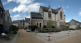 The church in Béhuard | |
 Coat of arms | |
show Location of Béhuard | |
 Béhuard | |
| Coordinates: 47°22′48″N 0°38′34″W / 47.38°N 0.6428°WCoordinates: 47°22′48″N 0°38′34″W / 47.38°N 0.6428°W | |
| Country | France |
| Region | Pays de la Loire |
| Department | Maine-et-Loire |
| Arrondissement | Angers |
| Canton | Angers-3 |
| Intercommunality | CU Angers Loire Métropole |
| Government | |
| • Mayor (2020–2026) | Bruno Richou[1] |
| Area 1 | 2.21 km2 (0.85 sq mi) |
| Population (Jan. 2018)[2] | 125 |
| • Density | 57/km2 (150/sq mi) |
| Time zone | UTC+01:00 (CET) |
| • Summer (DST) | UTC+02:00 (CEST) |
| INSEE/Postal code | 49028 /49170 |
| Elevation | 12–16 m (39–52 ft) (avg. 17 m or 56 ft) |
| 1 French Land Register data, which excludes lakes, ponds, glaciers > 1 km2 (0.386 sq mi or 247 acres) and river estuaries. | |


Béhuard (French pronunciation: [be.ɥaʁ]) is a commune in the Maine-et-Loire department in western France.
Population[]
|
|
See also[]
- Communes of the Maine-et-Loire department
References[]
- ^ "Répertoire national des élus: les maires". data.gouv.fr, Plateforme ouverte des données publiques françaises (in French). 2 December 2020.
- ^ "Populations légales 2018". INSEE. 28 December 2020.
| Wikimedia Commons has media related to Béhuard. |
| show Communes of the Maine-et-Loire department |
|---|
This Maine-et-Loire geographical article is a stub. You can help Wikipedia by . |
Categories:
- Communes of Maine-et-Loire
- Maine-et-Loire geography stubs