Saint-Sigismond, Maine-et-Loire
Saint-Sigismond | |
|---|---|
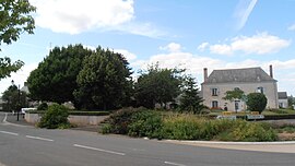 The centre of the village | |
show Location of Saint-Sigismond | |
 Saint-Sigismond | |
| Coordinates: 47°27′16″N 0°56′29″W / 47.4544°N 0.9414°WCoordinates: 47°27′16″N 0°56′29″W / 47.4544°N 0.9414°W | |
| Country | France |
| Region | Pays de la Loire |
| Department | Maine-et-Loire |
| Arrondissement | Segré |
| Canton | Chalonnes-sur-Loire |
| Intercommunality | Vallées du Haut-Anjou |
| Area 1 | 12.72 km2 (4.91 sq mi) |
| Population (Jan. 2018)[1] | 384 |
| • Density | 30/km2 (78/sq mi) |
| Time zone | UTC+01:00 (CET) |
| • Summer (DST) | UTC+02:00 (CEST) |
| INSEE/Postal code | 49321 /49123 |
| Elevation | 24–86 m (79–282 ft) (avg. 68 m or 223 ft) |
| 1 French Land Register data, which excludes lakes, ponds, glaciers > 1 km2 (0.386 sq mi or 247 acres) and river estuaries. | |


Saint-Sigismond is a commune in the Maine-et-Loire department in western France.
See also[]
- Communes of the Maine-et-Loire department
References[]
- ^ "Populations légales 2018". INSEE. 28 December 2020.
| Wikimedia Commons has media related to Saint-Sigismond (Maine-et-Loire). |
This Maine-et-Loire geographical article is a stub. You can help Wikipedia by . |
Categories:
- Communes of Maine-et-Loire
- Maine-et-Loire geography stubs