Saint-Léger-sous-Cholet
Saint-Léger-sous-Cholet | |
|---|---|
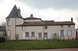 The town hall of Saint-Léger-sous-Cholet | |
show Location of Saint-Léger-sous-Cholet | |
 Saint-Léger-sous-Cholet | |
| Coordinates: 47°05′35″N 0°54′29″W / 47.093°N 0.908°WCoordinates: 47°05′35″N 0°54′29″W / 47.093°N 0.908°W | |
| Country | France |
| Region | Pays de la Loire |
| Department | Maine-et-Loire |
| Arrondissement | Cholet |
| Canton | Sèvremoine |
| Intercommunality | CA Choletais |
| Government | |
| • Mayor (2020–2026) | Jean-Paul Olivares[1] |
| Area 1 | 9.72 km2 (3.75 sq mi) |
| Population (Jan. 2018)[2] | 2,974 |
| • Density | 310/km2 (790/sq mi) |
| Time zone | UTC+01:00 (CET) |
| • Summer (DST) | UTC+02:00 (CEST) |
| INSEE/Postal code | 49299 /49280 |
| Elevation | 93–132 m (305–433 ft) |
| 1 French Land Register data, which excludes lakes, ponds, glaciers > 1 km2 (0.386 sq mi or 247 acres) and river estuaries. | |


Saint-Léger-sous-Cholet (French pronunciation: [sɛ̃ leʒe su ʃɔlɛ] (![]() listen), literally Saint-Léger under Cholet) is a commune in the Maine-et-Loire department in western France.
listen), literally Saint-Léger under Cholet) is a commune in the Maine-et-Loire department in western France.
See also[]
- Communes of the Maine-et-Loire department
References[]
- ^ "Répertoire national des élus: les maires". data.gouv.fr, Plateforme ouverte des données publiques françaises (in French). 2 December 2020.
- ^ "Populations légales 2018". INSEE. 28 December 2020.
| Wikimedia Commons has media related to Saint-Léger-sous-Cholet. |
This Maine-et-Loire geographical article is a stub. You can help Wikipedia by . |
Categories:
- Communes of Maine-et-Loire
- Maine-et-Loire geography stubs