Val d'Erdre-Auxence
Val d'Erdre-Auxence | |
|---|---|
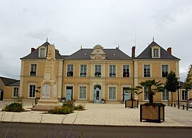 The town hall in Louroux-Béconnais | |
Location of Val d'Erdre-Auxence  | |
 Val d'Erdre-Auxence | |
| Coordinates: 47°31′23″N 0°53′06″W / 47.523°N 0.885°WCoordinates: 47°31′23″N 0°53′06″W / 47.523°N 0.885°W | |
| Country | France |
| Region | Pays de la Loire |
| Department | Maine-et-Loire |
| Arrondissement | Segré |
| Canton | Chalonnes-sur-Loire |
| Intercommunality | Vallées du Haut-Anjou |
| Area 1 | 213.22 km2 (82.32 sq mi) |
| Population (Jan. 2018)[1] | 4,897 |
| • Density | 23/km2 (59/sq mi) |
| Time zone | UTC+01:00 (CET) |
| • Summer (DST) | UTC+02:00 (CEST) |
| INSEE/Postal code | 49183 /49370 |
| 1 French Land Register data, which excludes lakes, ponds, glaciers > 1 km2 (0.386 sq mi or 247 acres) and river estuaries. | |


Val d'Erdre-Auxence is a commune in the Maine-et-Loire department of western France. The municipality was established on 15 December 2016 and consists of the former communes of La Cornuaille, Le Louroux-Béconnais and Villemoisan.[2]
See also[]
- Communes of the Maine-et-Loire department
References[]
| Wikimedia Commons has media related to Val d'Erdre-Auxence. |
- ^ "Populations légales 2018". The National Institute of Statistics and Economic Studies. 28 December 2020.
- ^ Arrêté préfectoral 30 September 2016 (in French)
This Maine-et-Loire geographical article is a stub. You can help Wikipedia by . |
Categories:
- Communes of Maine-et-Loire
- Maine-et-Loire geography stubs