Saint-Lambert-la-Potherie
Saint-Lambert-la-Potherie | |
|---|---|
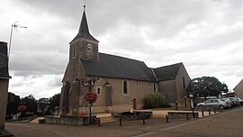 The church of Saint-Lambert | |
show Location of Saint-Lambert-la-Potherie | |
 Saint-Lambert-la-Potherie | |
| Coordinates: 47°29′02″N 0°40′34″W / 47.484°N 0.676°WCoordinates: 47°29′02″N 0°40′34″W / 47.484°N 0.676°W | |
| Country | France |
| Region | Pays de la Loire |
| Department | Maine-et-Loire |
| Arrondissement | Angers |
| Canton | Angers-3 |
| Intercommunality | CU Angers Loire Métropole |
| Government | |
| • Mayor (2020–2026) | Corinne Grosset |
| Area 1 | 13.81 km2 (5.33 sq mi) |
| Population (Jan. 2018)[1] | 2,880 |
| • Density | 210/km2 (540/sq mi) |
| Time zone | UTC+01:00 (CET) |
| • Summer (DST) | UTC+02:00 (CEST) |
| INSEE/Postal code | 49294 /49070 |
| Elevation | 39–76 m (128–249 ft) (avg. 40 m or 130 ft) |
| 1 French Land Register data, which excludes lakes, ponds, glaciers > 1 km2 (0.386 sq mi or 247 acres) and river estuaries. | |


Saint-Lambert-la-Potherie is a commune in the Maine-et-Loire department in western France.
See also[]
- Communes of the Maine-et-Loire department
References[]
- ^ "Populations légales 2018". INSEE. 28 December 2020.
| Wikimedia Commons has media related to Saint-Lambert-la-Potherie. |
This Maine-et-Loire geographical article is a stub. You can help Wikipedia by . |
Categories:
- Communes of Maine-et-Loire
- Maine-et-Loire geography stubs