Doué-en-Anjou
Doué-en-Anjou | |
|---|---|
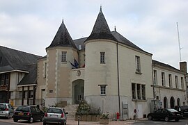 The town hall of Doué-en-Anjou | |
show Location of Doué-en-Anjou | |
 Doué-en-Anjou | |
| Coordinates: 47°11′38″N 0°16′26″W / 47.194°N 0.274°WCoordinates: 47°11′38″N 0°16′26″W / 47.194°N 0.274°W | |
| Country | France |
| Region | Pays de la Loire |
| Department | Maine-et-Loire |
| Arrondissement | Saumur |
| Canton | Doué-en-Anjou |
| Intercommunality | CA Saumur Val de Loire |
| Government | |
| • Mayor (2020–2026) | Michel Pattée |
| Area 1 | 148.55 km2 (57.36 sq mi) |
| Population (Jan. 2018)[1] | 11,100 |
| • Density | 75/km2 (190/sq mi) |
| Time zone | UTC+01:00 (CET) |
| • Summer (DST) | UTC+02:00 (CEST) |
| INSEE/Postal code | 49125 /49700 |
| 1 French Land Register data, which excludes lakes, ponds, glaciers > 1 km2 (0.386 sq mi or 247 acres) and river estuaries. | |


Doué-en-Anjou (French pronunciation: [dwe ɑ̃.n‿ɑ̃ʒu] (![]() listen), literally Doué in Anjou) is a commune in the Maine-et-Loire department of western France. The municipality was established on 30 December 2016 and consists of the former communes of Brigné, Concourson-sur-Layon, Doué-la-Fontaine, Forges, Meigné, Montfort, Saint-Georges-sur-Layon and Les Verchers-sur-Layon.[2]
listen), literally Doué in Anjou) is a commune in the Maine-et-Loire department of western France. The municipality was established on 30 December 2016 and consists of the former communes of Brigné, Concourson-sur-Layon, Doué-la-Fontaine, Forges, Meigné, Montfort, Saint-Georges-sur-Layon and Les Verchers-sur-Layon.[2]
See also[]
- Communes of the Maine-et-Loire department
References[]
| Wikimedia Commons has media related to Doué-en-Anjou. |
- ^ "Populations légales 2018". INSEE. 28 December 2020.
- ^ Arrêté préfectoral 23 September 2016 (in French)
This Maine-et-Loire geographical article is a stub. You can help Wikipedia by . |
Categories:
- Communes of Maine-et-Loire
- Anjou
- Maine-et-Loire geography stubs