Saint-Jean-de-la-Ruelle
show This article may be expanded with text translated from the corresponding article in French. (November 2020) Click [show] for important translation instructions. |
Saint-Jean-de-la-Ruelle | |
|---|---|
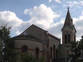 The church in Saint-Jean-de-la-Ruelle | |
 Coat of arms | |
show Location of Saint-Jean-de-la-Ruelle | |
 Saint-Jean-de-la-Ruelle | |
| Coordinates: 47°54′50″N 1°52′28″E / 47.9139°N 1.8745°ECoordinates: 47°54′50″N 1°52′28″E / 47.9139°N 1.8745°E | |
| Country | France |
| Region | Centre-Val de Loire |
| Department | Loiret |
| Arrondissement | Orléans |
| Canton | Saint-Jean-de-la-Ruelle |
| Intercommunality | Orléans Métropole |
| Government | |
| • Mayor (2020–2026) | Christophe Chaillou |
| Area 1 | 6.06 km2 (2.34 sq mi) |
| Population (Jan. 2018)[1] | 16,445 |
| • Density | 2,700/km2 (7,000/sq mi) |
| Time zone | UTC+01:00 (CET) |
| • Summer (DST) | UTC+02:00 (CEST) |
| INSEE/Postal code | 45285 /45140 |
| Elevation | 90–121 m (295–397 ft) |
| 1 French Land Register data, which excludes lakes, ponds, glaciers > 1 km2 (0.386 sq mi or 247 acres) and river estuaries. | |


Saint-Jean-de-la-Ruelle (pronounced [sɛ̃ ʒɑ̃ d(ə) la ʁɥɛl]) is a commune in the Loiret department in the administrative region of Centre-Val de Loire, France.
It is located about 3,5 km (2.2 mi) from Orléans.
Personalities[]
- Dosseh, rapper and actor
- Stéphane Kakou, footballer
International relations[]
Saint-Jean-de-la-Ruelle is twinned with:
 Gommern, Saxony-Anhalt, Germany
 Amposta, Catalonia, Spain
 Niepołomice, Lesser Poland, Poland
 Niantjila, Koulikoro Region, Mali
See also[]
- Communes of the Loiret department
References[]
- ^ "Populations légales 2018". INSEE. 28 December 2020.
| Wikimedia Commons has media related to Saint-Jean-de-la-Ruelle. |
| show Communes of the Loiret department |
|---|
| show Authority control |
|---|
This Loiret geographical article is a stub. You can help Wikipedia by . |
Categories:
- Communes of Loiret
- Loiret geography stubs