Saint-Norbert-d'Arthabaska, Quebec
Saint-Norbert-d'Arthabaska | |
|---|---|
Municipality | |
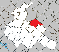 Location within Arthabaska RCM. | |
 Saint-Norbert-d'Arthabaska Location in southern Quebec. | |
| Coordinates: 46°06′N 71°49′W / 46.100°N 71.817°WCoordinates: 46°06′N 71°49′W / 46.100°N 71.817°W[1] | |
| Country | |
| Province | |
| Region | Centre-du-Québec |
| RCM | Arthabaska |
| Constituted | October 21, 2009 |
| Government | |
| • Mayor | Ghislain Caouette |
| • Federal riding | Richmond—Arthabaska |
| • Prov. riding | Arthabaska |
| Area | |
| • Total | 102.70 km2 (39.65 sq mi) |
| • Land | 103.72 km2 (40.05 sq mi) |
| There is an apparent contradiction between two authoritative sources | |
| Population (2011)[3] | |
| • Total | 1,185 |
| • Density | 11.4/km2 (30/sq mi) |
| • Pop 2006-2011 | |
| Time zone | UTC−5 (EST) |
| • Summer (DST) | UTC−4 (EDT) |
| Postal code(s) | G0P 1B0 |
| Area code(s) | 819 |
| Highways | |

Saint-Norbert-d'Arthabaska is a municipality located in the Centre-du-Québec region of Quebec, Canada.
References[]
- ^ Reference number 296320 of the Commission de toponymie du Québec (in French)
- ^ Jump up to: a b Geographic code 39043 in the official Répertoire des municipalités (in French)
- ^ Jump up to: a b "(Code 2439043) Census Profile". 2011 census. Statistics Canada. 2012.
| show Places adjacent to Saint-Norbert-d'Arthabaska, Quebec |
|---|
| show |
|---|
| Authority control |
|
|---|
This Quebec location article is a stub. You can help Wikipedia by . |
Categories:
- Municipalities in Quebec
- Incorporated places in Centre-du-Québec
- Quebec geography stubs