Saint-Rémi-de-Tingwick, Quebec
Saint-Rémi-de-Tingwick | |
|---|---|
Municipality | |
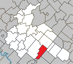 Location within Arthabaska RCM. | |
 Saint-Rémi-de-Tingwick Location in southern Quebec. | |
| Coordinates: 45°52′N 71°49′W / 45.867°N 71.817°WCoordinates: 45°52′N 71°49′W / 45.867°N 71.817°W[1] | |
| Country | |
| Province | |
| Region | Centre-du-Québec |
| RCM | Arthabaska |
| Constituted | January 1, 1882 |
| Government | |
| • Mayor | Estelle Luneau |
| • Federal riding | Richmond—Arthabaska |
| • Prov. riding | Drummond–Bois-Francs |
| Area | |
| • Total | 73.80 km2 (28.49 sq mi) |
| • Land | 73.33 km2 (28.31 sq mi) |
| Population | |
| • Total | 474 |
| • Density | 6.5/km2 (17/sq mi) |
| • Pop 2006-2011 | |
| Postal code(s) | J0A 1K0 |
| Area code(s) | 819 |
| Highways | No major routes |
| Website | www.st-remi-de- tingwick.qc.ca |

Saint-Rémi-de-Tingwick is a municipality located in the Centre-du-Québec region of Quebec, Canada.
References[]
- ^ Reference number 57573 of the Commission de toponymie du Québec (in French)
- ^ Jump up to: a b Geographic code 39020 in the official Répertoire des municipalités (in French)
- ^ Jump up to: a b "(Code 2439020) Census Profile". 2011 census. Statistics Canada. 2012.
| show Places adjacent to Saint-Rémi-de-Tingwick, Quebec |
|---|
| show |
|---|
This Quebec location article is a stub. You can help Wikipedia by . |
Categories:
- Municipalities in Quebec
- Incorporated places in Centre-du-Québec
- Quebec geography stubs