Saint-Samuel, Quebec
Saint-Samuel | |
|---|---|
Municipality | |
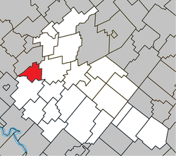 Location within Arthabaska RCM. | |
 Saint-Samuel Location in southern Quebec. | |
| Coordinates: 46°04′N 72°13′W / 46.067°N 72.217°WCoordinates: 46°04′N 72°13′W / 46.067°N 72.217°W[1] | |
| Country | |
| Province | |
| Region | Centre-du-Québec |
| RCM | Arthabaska |
| Constituted | March 9, 1878 |
| Government | |
| • Mayor | René Mongrain |
| • Federal riding | Richmond—Arthabaska |
| • Prov. riding | Drummond–Bois-Francs |
| Area | |
| • Total | 44.40 km2 (17.14 sq mi) |
| • Land | 43.36 km2 (16.74 sq mi) |
| Population | |
| • Total | 743 |
| • Density | 17.1/km2 (44/sq mi) |
| • Pop 2006-2011 | |
| Postal code(s) | G0Z 1G0 |
| Area code(s) | 819 |
| Website | www |

Saint-Samuel is a municipality located in the Centre-du-Québec region of Quebec, Canada.
References[]
- ^ Reference number 57609 of the Commission de toponymie du Québec (in French)
- ^ Jump up to: a b Geographic code 39130 in the official Répertoire des municipalités (in French)
- ^ Jump up to: a b "(Code 2439130) Census Profile". 2011 census. Statistics Canada. 2012.
| show Places adjacent to Saint-Samuel, Quebec |
|---|
| show |
|---|
| show Authority control |
|---|
This Quebec location article is a stub. You can help Wikipedia by . |
Categories:
- Municipalities in Quebec
- Incorporated places in Centre-du-Québec
- Quebec geography stubs