Signagi Municipality
Signagi Municipality
სიღნაღის მუნიციპალიტეტი | |
|---|---|
Municipality | |
 Town of Sighnaghi | |
 Flag  Seal | |
 Signagi Municipality | |
| Country | |
| Mkhare | Kakheti |
| capital city | Signagi |
| Government | |
| • mayor | Giorgi Gogilashvili [1] |
| Area | |
| • Total | 1,252 km2 (483 sq mi) |
| Population (2014) | |
| • Total | 29,948 |
| • Density | 23.93/km2 (62.0/sq mi) |
| Population by ethnicity[2] | |
| • Georgians | 97.44 % |
| • Armenians | 0.73 % |
| • Russians | 0.70 % |
| • Yazidis | 0.34 % |
| • Azerbaijanis | 0.33 % |
| Time zone | UTC+4 (Georgian Standard Time) |
| Website | http://www.signagi.gov.ge/ge |
Sighnaghi (Georgian: სიღნაღის მუნიციპალიტეტი) is a municipality of Georgia, in the region of Kakheti. Its main town is Sighnaghi.
Population: 29,530 (2019 estimate)
Area: 1,251 km2
Geography and climate[]
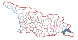
Sighnaghi Municipality is located in Eastern Georgia, in the Kakheti region. Its administrative center is the city of Sighnaghi. The municipality is bordered by Gurjaani Municipality and Sagarejo Municipality municipalities to the northwest and west, Dedoplistskaro Municipality to the southeast, Lagodekhi Municipality to the north and northeast, and the Republic of Azerbaijan. A large part of Sighnaghi municipality is occupied by the Iori Plateau. A small part of Gombori ridge also enters on its territory. The highest mountain in the Gombori ridge within the municipality is Choporti (1087 m).
Sighnaghi lacks a hydrographic network. There are mostly periodic rivers here. We must distinguish two rivers, the Alazani and the . Thorn bushes are spread on Iori highland. In the southern part of the Iori Plateau we find the bush saltwort, from which soda is extracted. There are floodplain forests along the banks of the river Iori: Tsnori, floodplain poplar, Ialghuni, etc. Oak and hornbeam are noteworthy in the forests of Gombori ridge. There are several types of climate in the territory of Sighnaghi municipality. The Iori plateau has a moderately humid steppe climate, with hot summers and cold winters. The Alazani plain has a moderately humid climate, where the winters are moderately cold and the summers are hot. The Gombori ridge has a moderately humid and moderately warm climate with cold winters and long warm summers. The average annual air temperature ranges from 11.1 ° C to 12.6 ° C. [3]
History and etymology[]
Sighnaghi is a municipality located in the Kakheti region. It is determined by archeological excavations that this area played an important role since the Paleolithic, Neolithic and Bronze Ages. The territory of Sighnaghi district was formerly known as Kambechovani, and later it was called Kiziki. After the recognition of Christianity as the state religion in Georgia, this side acquired great importance. St. Nino was executed and buried here. Sighnaghi is a word of Turkish origin and means shelter. [4]
Politics[]

Sighnaghi Municipal Assembly (Georgian: სიღნაღის საკრებულო) is a representative body in Sighnaghi Municipality. currently consisting of 27 members. The council is assembles into session regularly, to consider subject matters such as code changes, utilities, taxes, city budget, oversight of city government and more. Sighnaghi sakrebulo is elected every four year. The last election was held in October 2017. [5]
| Party | Seats | Current Municipal Assembly | |||||||||||||||||||||||
|---|---|---|---|---|---|---|---|---|---|---|---|---|---|---|---|---|---|---|---|---|---|---|---|---|---|
| Georgian Dream | 21 | ||||||||||||||||||||||||
| UNM | 4 | ||||||||||||||||||||||||
| European Georgia | 1 | ||||||||||||||||||||||||
| Alliance of Patriots | 1 | ||||||||||||||||||||||||
Population[]

The municipality is divided into the independent cities of Sighnaghi and Tsnori as well as 12 municipalities (Georgian temi, თემი or simply "village", Georgian sopeli, სოფელი):
- Vaqiri
- Bodbe
- Sakobo
- Kvemo Machkhani
- Jugaani
- Anaga
- Bodbiskhevi
- Iliatsminda
- Magharo
- Nukriani
- Tibaani
- Old Anaga
Tourism and historical sites[]

Nature[]
- Kilakupra mud volcanoes
Cultural monuments[]
- Sabereebi
- Church of St. John the Baptist in Vaqiri
See also[]
- Districts of Georgia (country)
References[]
- ^ http://www.signagi.gov.ge/ge/meri
- ^ "Ethnic composition of Georgia 2014". Population statistics of Eastern Europe & former USSR (in Occitan). Retrieved 2021-02-05.
- ^ https://georgiantravelguide.com/en/sighnaghi
- ^ https://georgiantravelguide.com/en/sighnaghi
- ^ https://cesko.ge/res/docs/danOK47.pdf
External links[]
- Districts of Georgia, Statoids.com
Coordinates: 41°36′55″N 45°54′46″E / 41.61528°N 45.91278°E

This Georgia location article is a stub. You can help Wikipedia by . |
- Municipalities of Kakheti
- Georgia (country) geography stubs