Sobotín
Sobotín | |
|---|---|
 General view of Sobotín | |
 Flag  Coat of arms | |
 Sobotín Location in the Czech Republic | |
| Coordinates: 50°0′42″N 17°5′27″E / 50.01167°N 17.09083°ECoordinates: 50°0′42″N 17°5′27″E / 50.01167°N 17.09083°E | |
| Country | |
| Region | Olomouc |
| District | Šumperk |
| First mentioned | 1351 |
| Area | |
| • Total | 31.94 km2 (12.33 sq mi) |
| Elevation | 425 m (1,394 ft) |
| Population (2020-01-01[1]) | |
| • Total | 1,146 |
| • Density | 36/km2 (93/sq mi) |
| Time zone | UTC+1 (CET) |
| • Summer (DST) | UTC+2 (CEST) |
| Postal code | 788 16 |
| Website | www |

Sobotín (German: Zöptau) is a municipality and village in Šumperk District in the Olomouc Region of the Czech Republic. It has about 1,100 inhabitants.
Sobotín lies approximately 11 kilometres (7 mi) north-east of Šumperk, 48 km (30 mi) north of Olomouc, and 192 km (119 mi) east of Prague.
Administrative parts[]
Villages of Klepáčov and Rudoltice are administrative parts of Sobotín.
History[]
The first written mention of Sobotín is from 1351. The history of Sobotín is connected with the iron ore mining in the area.[2]
On 1 January 2010 a new municipality Petrov nad Desnou (including the village of Petrov nad Desnou and settlement Terezín) separated from Sobotín.[2]
One of the more important landmarks in the municipality include the Klein family mausoleum. Kleins were a family of German businesspeople who were very active in the life of the municipality. They were expelled after World War II together with the German population of the municipality.
Gallery[]
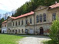
Old industrial building in Sobotín

Klein family mausoleum

Church of Saint Lawrence


References[]
- ^ "Population of Municipalities – 1 January 2020". Czech Statistical Office. 30 April 2020.
- ^ Jump up to: a b "Historie obce" (in Czech). Obec Sobotín. Retrieved 24 November 2020.
| Wikimedia Commons has media related to Sobotín. |
| Authority control: National libraries |
|---|
This Olomouc Region location article is a stub. You can help Wikipedia by . |
- Villages in Šumperk District
- Olomouc Region geography stubs