Stáj
Stáj | |
|---|---|
Municipality | |
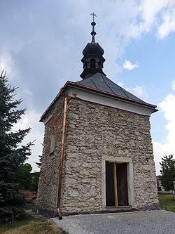 Chapel of Saint John of Nepomuk | |
 Flag  Coat of arms | |
 Stáj | |
| Coordinates: 49°27′29″N 15°48′29″E / 49.45806°N 15.80806°ECoordinates: 49°27′29″N 15°48′29″E / 49.45806°N 15.80806°E | |
| Country | |
| Region | Vysočina |
| District | Jihlava |
| Area | |
| • Total | 5.92 km2 (2.29 sq mi) |
| Elevation | 602 m (1,975 ft) |
| Population (2006) | |
| • Total | 177 |
| • Density | 30/km2 (77/sq mi) |
| Postal code | 588 26 to 588 27 |
| Website | http://www.obec-staj.unas.cz |

Stáj (Czech pronunciation: [ˈstaːj]) is a village and municipality (obec) in Jihlava District in the Vysočina Region of the Czech Republic.
The municipality covers an area of 5.92 square kilometres (2.29 sq mi), and has a population of 177 (as at 28 August 2006).
Stáj lies approximately 18 kilometres (11 mi) north-east of Jihlava and 122 km (76 mi) south-east of Prague.
References[]
| Authority control: National libraries |
|---|
This Vysočina Region location article is a stub. You can help Wikipedia by . |
Categories:
- Villages in Jihlava District
- Vysočina Region geography stubs