Dobronín
Dobronín | |
|---|---|
 General view of Dobronín | |
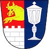
 Flag  Coat of arms | |
 Dobronín Location in the Czech Republic | |
| Coordinates: 49°28′42″N 15°39′0″E / 49.47833°N 15.65000°ECoordinates: 49°28′42″N 15°39′0″E / 49.47833°N 15.65000°E | |
| Country | |
| Region | Vysočina |
| District | Jihlava |
| First mentioned | 1351 |
| Area | |
| • Total | 13.73 km2 (5.30 sq mi) |
| Elevation | 475 m (1,558 ft) |
| Population (2020-01-01[1]) | |
| • Total | 1,860 |
| • Density | 140/km2 (350/sq mi) |
| Time zone | UTC+1 (CET) |
| • Summer (DST) | UTC+2 (CEST) |
| Postal code | 588 12 |
| Website | www |
Dobronín (Czech pronunciation: [ˈdobroɲiːn]; German: Dobrenz) is a municipality and village in Jihlava District in the Vysočina Region of the Czech Republic. It has about 1,900 inhabitants.
Dobronín lies approximately 11 kilometres (7 mi) north-east of Jihlava and 112 km (70 mi) south-east of Prague.
History[]
In May 1945, after World War II, local Czechs massacred more than dozen local ethnic German civilians. Since 2009, police investigation continues in that case, as more human remains are unearthed in the village.[2]
Twin towns – sister cities[]
 Bellmund, Switzerland
References[]
- ^ "Population of Municipalities – 1 January 2020". Czech Statistical Office. 30 April 2020.
- ^ "Czech archaeologists find bodies of Germans massacred in 1945". Deutsche Welle. 19 August 2010. Retrieved 20 August 2010.
- ^ "Rozcestník". dobronin.cz (in Czech). Obec Dobronín. Retrieved 9 October 2020.
| Wikimedia Commons has media related to Dobronín. |
Categories:
- Villages in Jihlava District
- Vysočina Region geography stubs
