Licab
This article needs additional citations for verification. (October 2012) |
Licab | |
|---|---|
| Municipality of Licab | |
     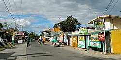 (From top, left to right): Licab Municipal Hall building, Our Lady of the Holy Rosary Parish, Liwasang Dalmacio, Saint Christopher Academy, Old Town Center Welcome Sign, Downtown area | |
 Seal | |
 Map of Nueva Ecija with Licab highlighted | |
OpenStreetMap  | |
 Licab Location within the Philippines | |
| Coordinates: 15°32′38″N 120°45′48″E / 15.5439°N 120.7634°ECoordinates: 15°32′38″N 120°45′48″E / 15.5439°N 120.7634°E | |
| Country | Philippines |
| Region | Central Luzon |
| Province | Nueva Ecija |
| District | 1st district |
| Barangays | 11 (see Barangays) |
| Government | |
| • Type | Sangguniang Bayan |
| • Mayor | Eufemia D. Domingo |
| • Vice Mayor | Albert M. Caraang |
| • Representative | Estrellita B. Suansing |
| • Municipal Council | Members |
| • Electorate | 17,436 voters (2019) |
| Area | |
| • Total | 67.37 km2 (26.01 sq mi) |
| Elevation | 24 m (79 ft) |
| Highest elevation | 38 m (125 ft) |
| Lowest elevation | 17 m (56 ft) |
| Population (2020 census) [3] | |
| • Total | 29,269 |
| • Density | 430/km2 (1,100/sq mi) |
| • Households | 6,374 |
| Economy | |
| • Income class | 4th municipal income class |
| • Poverty incidence | 18.62% (2015)[4] |
| • Revenue | ₱110,730,910.31 (2020) |
| • Assets | ₱252,397,218.77 (2020) |
| • Expenditure | ₱106,075,577.46 (2020) |
| • Liabilities | ₱93,459,213.41 (2020) |
| Service provider | |
| • Electricity | Nueva Ecija 2 Area 1 Electric Cooperative (NEECO 2 A1) |
| Time zone | UTC+8 (PST) |
| ZIP code | 3112 |
| PSGC | |
| IDD : area code | +63 (0)44 |
| Native languages | Tagalog Ilocano |

Licab, officially the Municipality of Licab (Tagalog: Bayan ng Licab; Ilocano: Ili ti Licab; Pangasinan: Baley na Licab), is a 4th class municipality in the province of Nueva Ecija, Philippines. According to the 2020 census, it has a population of 29,269 people. [3]
History[]
Licab is a former sitio under the municipality of Aliaga and was known as "Pulong Samat". A wooded area surrounded by rivers and streams, it was then inhabited by thirty families consisting of Ilocanos, Kapampangan and Tagalog, until the Esguerra brothers arrived and lived with the locals.
Don Dalmacio, one of the Esguerra brothers, led the clearing of the vast grasslands and brushwood with his brothers and the locals, subsequently cultivating the area with a bountiful harvest.
Due to the increase in the population of Pulong Samat, Dalmacio directed the establishment of a "gunglo" which served as Pulong Samat's council or government. The aforementioned council began to change the name of Pulong Samat and later used "Licab" which came from the ilocano saying "kaskada agliklikab ti ani ti pagay da" which means "the collected rice is flowing".
In 1882, led by Don Dalmacio, the local heads of the barrios of Santa Maria, Licab, Bantog and neighboring sitios, presented a petition to the civil administration of the Spanish government in the Philippines for the establishment of a separate municipality from the municipality of Aliaga.
After more than ten years, having fulfilled the requirements prescribed by the leaders of the Spanish government in the Philippines, the order to establish the municipality of Licab was adopted under the leadership of the governor general Ramón Blanco and took into effect on March 28, 1894.[5]
Geography[]
About 155 kilometres (96 mi) north of Metro Manila, Licab lies in one of the lowest portions of the province with an average elevation of 24 metres (79 ft),[6] experiencing flooding in all but one of its 11 barangays during rainy season.
Barangays[]
Licab is politically subdivided into 11 barangays.
| PSGC | Barangay | Population | ±% p.a. | Area | PD 2020 | |||||
|---|---|---|---|---|---|---|---|---|---|---|
| 2020 [3] | 2010 [7] | ha | acre | /km2 | /sq mi | |||||
| 034914013 | Aquino | 8.5% | 2,476 | 2,292 | 0.79% | 1,213 | 2,997 | 200 | 530 | |
| 034914002 | Linao | 4.7% | 1,388 | 1,210 | 1.41% | 356 | 880 | 390 | 1,000 | |
| 034914003 | Poblacion Norte | 4.8% | 1,393 | 1,336 | 0.43% | 77 | 191 | 1,800 | 4,700 | |
| 034914004 | Poblacion Sur | 8.8% | 2,565 | 2,483 | 0.33% | 88 | 216 | 2,900 | 7,600 | |
| 034914005 | San Casimiro | 11.2% | 3,268 | 2,868 | 1.34% | 407 | 1,005 | 800 | 2,100 | |
| 034914006 | San Cristobal | 12.7% | 3,721 | 3,532 | 0.53% | 491 | 1,214 | 760 | 2,000 | |
| 034914007 | San Jose | 5.0% | 1,449 | 1,328 | 0.89% | 356 | 881 | 410 | 1,100 | |
| 034914008 | San Juan | 12.4% | 3,641 | 3,297 | 1.02% | 932 | 2,303 | 390 | 1,000 | |
| 034914009 | Santa Maria | 14.5% | 4,249 | 3,992 | 0.64% | 1,663 | 4,108 | 260 | 660 | |
| 034914011 | Tabing Ilog | 3.5% | 1,031 | 869 | 1.76% | 336 | 829 | 310 | 800 | |
| 034914012 | Villarosa | 10.5% | 3,073 | 2,980 | 0.31% | 819 | 2,023 | 380 | 970 | |
| Total | 29,269 | 26,187 | 1.14% | 6,737 | 16,647 | 430 | 1,100 | |||
Climate[]
| Climate data for Licab, Nueva Ecija | |||||||||||||
|---|---|---|---|---|---|---|---|---|---|---|---|---|---|
| Month | Jan | Feb | Mar | Apr | May | Jun | Jul | Aug | Sep | Oct | Nov | Dec | Year |
| Average high °C (°F) | 29 (84) |
30 (86) |
32 (90) |
34 (93) |
33 (91) |
31 (88) |
30 (86) |
29 (84) |
30 (86) |
30 (86) |
30 (86) |
29 (84) |
31 (87) |
| Average low °C (°F) | 19 (66) |
20 (68) |
20 (68) |
22 (72) |
24 (75) |
24 (75) |
24 (75) |
24 (75) |
24 (75) |
22 (72) |
21 (70) |
20 (68) |
22 (72) |
| Average precipitation mm (inches) | 4 (0.2) |
6 (0.2) |
7 (0.3) |
12 (0.5) |
61 (2.4) |
89 (3.5) |
96 (3.8) |
99 (3.9) |
81 (3.2) |
88 (3.5) |
37 (1.5) |
13 (0.5) |
593 (23.5) |
| Average rainy days | 2.5 | 3.0 | 4.1 | 6.3 | 15.8 | 19.4 | 22.5 | 21.6 | 20.1 | 17.5 | 9.6 | 4.0 | 146.4 |
| Source: Meteoblue (modeled/calculated data, not measured locally)[8] | |||||||||||||
Demographics[]
|
| |||||||||||||||||||||||||||||||||||||||||||||||||||
| Source: Philippine Statistics Authority [9] [7] [10][11] | ||||||||||||||||||||||||||||||||||||||||||||||||||||
Economy[]
This section needs expansion. You can help by . (May 2021) |
| Poverty Incidence of Licab | |
| Source: Philippine Statistics Authority[12][13][14][15][16][17][18] | |

Agriculture has remained the prime industry of the municipality. Agricultural lands devoted to various agricultural activities cover about tens of thousands hectares out of the total provincial area of 550,718 hectares. Rice is still the prime crop of agricultural development and programs. Palay production in the town is boosted by a large network of irrigation facilities and other appurtenant structure.
Live stock production of piggery and poultry were the second agricultural income source in this municipality. Most of the residence were considered to be backyard raisers. Meat products sold in the public market were produced and raised locally.
Notable people[]
- Vic Manuel, basketball player
References[]
- ^ Municipality of Licab | (DILG)
- ^ "2015 Census of Population, Report No. 3 – Population, Land Area, and Population Density" (PDF). Philippine Statistics Authority. Quezon City, Philippines. August 2016. ISSN 0117-1453. Archived (PDF) from the original on May 25, 2021. Retrieved July 16, 2021.
- ^ a b c Census of Population (2020). "Region III (Central Luzon)". Total Population by Province, City, Municipality and Barangay. PSA. Retrieved 8 July 2021.
- ^ https://psa.gov.ph/sites/default/files/City%20and%20Municipal-level%20Small%20Area%20Poverty%20Estimates_%202009%2C%202012%20and%202015_0.xlsx; publication date: 10 July 2019; publisher: Philippine Statistics Authority.
- ^ "Maikling Kasaysayan ng Licab".
- ^ "Licab Topographic maps > Philippines > Nueva Ecija > Licab > Licab". topographic-map.com. Retrieved May 7, 2021.
- ^ a b Census of Population and Housing (2010). "Region III (Central Luzon)". Total Population by Province, City, Municipality and Barangay. NSO. Retrieved 29 June 2016.
- ^ "Licab: Average Temperatures and Rainfall". Meteoblue. Retrieved 4 May 2020.
- ^ Census of Population (2015). "Region III (Central Luzon)". Total Population by Province, City, Municipality and Barangay. PSA. Retrieved 20 June 2016.
- ^
Censuses of Population (1903–2007). "Region III (Central Luzon)". Table 1. Population Enumerated in Various Censuses by Province/Highly Urbanized City: 1903 to 2007. NSO.
{{cite encyclopedia}}: CS1 maint: url-status (link) - ^ "Province of Nueva Ecija". Municipality Population Data. Local Water Utilities Administration Research Division. Retrieved 17 December 2016.
- ^ "Poverty incidence (PI):". Philippine Statistics Authority. Retrieved 28 December 2020.
- ^ https://psa.gov.ph/sites/default/files/NSCB_LocalPovertyPhilippines_0.pdf; publication date: 29 November 2005; publisher: Philippine Statistics Authority.
- ^ https://psa.gov.ph/sites/default/files/2003%20SAE%20of%20poverty%20%28Full%20Report%29_1.pdf; publication date: 23 March 2009; publisher: Philippine Statistics Authority.
- ^ https://psa.gov.ph/sites/default/files/2006%20and%202009%20City%20and%20Municipal%20Level%20Poverty%20Estimates_0_1.pdf; publication date: 3 August 2012; publisher: Philippine Statistics Authority.
- ^ https://psa.gov.ph/sites/default/files/2012%20Municipal%20and%20City%20Level%20Poverty%20Estima7tes%20Publication%20%281%29.pdf; publication date: 31 May 2016; publisher: Philippine Statistics Authority.
- ^ https://psa.gov.ph/sites/default/files/City%20and%20Municipal-level%20Small%20Area%20Poverty%20Estimates_%202009%2C%202012%20and%202015_0.xlsx; publication date: 10 July 2019; publisher: Philippine Statistics Authority.
- ^ "PSA Releases the 2018 Municipal and City Level Poverty Estimates". Philippine Statistics Authority. 15 December 2021. Retrieved 22 January 2022.
External links[]
| Wikimedia Commons has media related to Licab. |
- Philippine Standard Geographic Code
- Philippine Census Information
- Local Governance Performance Management System
Places adjacent to Licab | ||||||||||||||||
|---|---|---|---|---|---|---|---|---|---|---|---|---|---|---|---|---|
| ||||||||||||||||
Palayan (capital) | |
| Municipalities | |
| Component cities | |
- Municipalities of Nueva Ecija