Tenza Valley
| Tenza Valley | |
|---|---|
 Chivor Reservoir and Dam in the Tenza Valley | |
 Topographical map of Boyacá Tenza Valley is located in the south the elongated Chivor Reservoir is inside the valley | |
| Floor elevation | 395–2,095 m (1,296–6,873 ft) |
| Geology | |
| Type | Valley |
| Geography | |
| Location | Eastern Ranges |
| Country | Colombia |
| State | Cundinamarca, Boyacá |
| Population centers | Tenza, Garagoa and Sutatenza |
| Coordinates | 5°05′00″N 73°25′00″W / 5.08333°N 73.41667°WCoordinates: 5°05′00″N 73°25′00″W / 5.08333°N 73.41667°W |
| River | Lengupá |


The Tenza Valley (Spanish: Valle de Tenza) is an in the Eastern Ranges of the Colombian Andes. The valley stretches over the southeastern part of the department of Boyacá and the northeastern part of Cundinamarca. It is located east of the Altiplano Cundiboyacense and in the time before the Spanish conquest of the Muisca, as the Altiplano was inhabited by the Muisca in the higher altitudes and the Tegua in the lower areas to the east.
Etymology[]
The Tenza Valley is named after Tenza which means in Chibcha: "Behind the mouth" or "Going down at night".[1]
Geography and geology[]
The Tenza Valley is situated in the Eastern Ranges of the Colombian Andes at altitudes between approximately 2,100 metres (6,900 ft) in the northwest and 400 metres (1,300 ft) in the southeast. The Lengupá River, part of the Orinoco drainage basin, flows through the valley and connects the higher altitude Altiplano Cundiboyacense with the Llanos Orientales.[2] The Une, , , Macanal and Bogotá Formations outcrop in the valley. The valley is rich in water.[3] The average temperature is 20 °C (68 °F).[4]
History[]
The Tenza Valley was inhabited by the Muisca before conquistador Gonzalo Jiménez de Quesada entered the central highlands of Colombia. The Tenza Valley was ruled by a cacique who was loyal to the zaque based in Hunza, present-day Tunja.[5] On the fertile lands of the valley the indigenous people elaborated their agriculture.[6] The valley was also important in the economy of the Muisca, hosting the important emerald resources of Chivor and Somondoco.
Archaeologist Juanita Sáenz Samper has discovered three agricultural terraces and five cemeteries hosting one grave and pertaining to pre-Columbian times. The research in the Tenza Valley has also uncovered typical grey ceramics of the area, called Valle de Tenza Gris.[7]
Modern times[]
The Chivor Reservoir, producing 8% of Colombia's hydroelectric energy, is located in the Tenza Valley.[6] Despite the pleasant climate compared to the colder regions of Boyacá, the Tenza Valley is not touristic.[4]
Economy[]
The temperate climate of the Tenza Valley allows for a variety in agriculture. Main products cultivated are maize, yuca, potatoes, , sugarcane, tomatoes, bananas, coffee, fique, arracacha, peas, beans, cucumbers, pumpkins, mangoes, chirimoya, oranges, avocadoes, pineapples, mandarines, papayas, maracuyá, guayaba and lulo.
In terms of mining, the emerald mines of Chivor and Somondoco are important. Coal mines and gold extraction form another part of the mining business in the valley. Salt is mined on a minor scale in Sutatenza and gypsum is exploited in Macanal.
Municipalities in the Tenza Valley[]
| Municipality | Department | Ruler(s) | Altitude urban centre (m) |
Surface area (km2) |
Remarks | hideMap |
|---|---|---|---|---|---|---|
| Tenza | Boyacá | cacique | 1600 | 51 | Namesake of the valley | 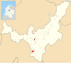 |
| Almeida | Boyacá | zaque | 1925 | 57.98 | Hydroelectric plant of the Chivor Reservoir |  |
| La Capilla | Boyacá | zaque | 1750 | 57.26 |  | |
| Chinavita | Boyacá | zaque | 1763 | 148 | 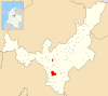 | |
| Chivor | Boyacá | cacique | 1800 | 108.36 | Important emerald mines | 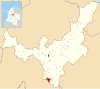 |
| Garagoa | Boyacá | zaque | 1650 | 191.75 | Seat of the Diocese (Catholic Church) | 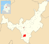 |
| Guateque | Boyacá | cacique | 1815 | 36.04 |  | |
| Guayatá | Boyacá | cacique | 1767 | 112 | Famous for its bread rolls (mogollas) | 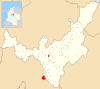 |
| Macanal | Boyacá | zaque | 1680 | 199.5 | Gypsum mining |  |
| Pachavita | Boyacá | zaque | 1985 | 68 |  | |
| Somondoco | Boyacá | zaque | 1670 | 58.7 | Emerald mines |  |
| Sutatenza | Boyacá | zaque | 1890 | 41.26 | Minor salt mining |  |
| Manta | Cundinamarca | cacique | 1924 | 105 | Possible birthplace of Jorge Eliécer Gaitán, assassinated in 1948 |
 |
| Machetá | Cundinamarca | zaque | 2094 | 229.35 |  | |
| Tibiritá | Cundinamarca | zaque | 1980 | 57.2 | 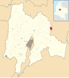 | |
| Santa María | Boyacá | Tegua | 850 | 326.44 |  | |
| San Luis de Gaceno | Boyacá | Tegua | 395 | 458.5 |  |
See also[]
References[]
- ^ (in Spanish) Etymology Tenza - Excelsio.net
- ^ (in Spanish) El Valle de Tenza, tesoro natural en el Piedemonte Llanero
- ^ (in Spanish) El Valle de Tenza, destino turístico para todos - El Tiempo
- ^ Jump up to: a b (in Spanish) Valle de Tenza, tesoro entre montañas - El Espectador
- ^ (in Spanish) Muisca people - Pueblos Originarios
- ^ Jump up to: a b (in Spanish) Principales valles de Boyacá
- ^ (in Spanish) Investigacíon arqueológica en el bajo Valle de Tenza, Boyacá
Further reading[]
- . 1989. Arqueología del alto Valle de Tenza - Archaeology of the upper Tenza Valley, 1–148. Banco de la República. Accessed 2016-07-08.
External links[]
- (in Spanish) Cycling route in the Tenza Valley
- (in Spanish) Video of the Tenza Valley
| hide | ||||||||||||||||||
|---|---|---|---|---|---|---|---|---|---|---|---|---|---|---|---|---|---|---|
| ||||||||||||||||||
| ||||||||||||||||||
| ||||||||||||||||||
| ||||||||||||||||||
| ||||||||||||||||||
| ||||||||||||||||||
| ||||||||||||||||||

| Authority control |
|
|---|
- Valleys of Colombia
- Geography of Boyacá Department
- Geography of Cundinamarca Department
- Muisca