Vermand
show This article may be expanded with text translated from the corresponding article in French. (December 2008) Click [show] for important translation instructions. |
Vermand | |
|---|---|
Commune | |
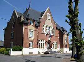 Town hall | |
 Coat of arms | |
show Location of Vermand | |
 Vermand | |
| Coordinates: 49°52′N 3°09′E / 49.87°N 3.15°ECoordinates: 49°52′N 3°09′E / 49.87°N 3.15°E | |
| Country | France |
| Region | Hauts-de-France |
| Department | Aisne |
| Arrondissement | Saint-Quentin |
| Canton | Saint-Quentin-1 |
| Intercommunality | Pays du Vermandois |
| Government | |
| • Mayor (2020–2026) | Jean-Pierre Boniface[1] |
| Area 1 | 15.75 km2 (6.08 sq mi) |
| Population (Jan. 2018)[2] | 1,097 |
| • Density | 70/km2 (180/sq mi) |
| Time zone | UTC+01:00 (CET) |
| • Summer (DST) | UTC+02:00 (CEST) |
| INSEE/Postal code | 02785 /02490 |
| 1 French Land Register data, which excludes lakes, ponds, glaciers > 1 km2 (0.386 sq mi or 247 acres) and river estuaries. | |


Vermand (French pronunciation: [vɛʁmɑ̃]) is a commune in the Aisne department in Hauts-de-France in northern France.
Vermand was probably the original capital of the Viromandui, after whom the region of Vermandois is named. It was later displaced by the Roman settlement of Augusta Viromanduorum, modern Saint-Quentin.[3]
Population[]
| Year | Pop. | ±% |
|---|---|---|
| 1962 | 998 | — |
| 1968 | 1,135 | +13.7% |
| 1975 | 1,165 | +2.6% |
| 1982 | 1,163 | −0.2% |
| 1990 | 1,118 | −3.9% |
| 1999 | 1,069 | −4.4% |
| 2008 | 1,036 | −3.1% |
See also[]
References[]
- ^ "Répertoire national des élus: les maires". data.gouv.fr, Plateforme ouverte des données publiques françaises (in French). 2 December 2020.
- ^ "Populations légales 2018". INSEE. 28 December 2020.
- ^ Jean-Luc Collart and Michèle Gaillard, [http
- //www.persee.fr/doc/sracf_1159-7151_2004_act_25_1_1220 "Vermand /Augusta Viromanduorum (Aisne)"], Supplément à la Revue archéologique du centre de la France, 25, 1 (2004): 493–96.
| Wikimedia Commons has media related to Vermand. |
| Authority control |
|
|---|
This Saint-Quentin arrondissement geographical article is a stub. You can help Wikipedia by . |
Categories:
- Communes of Aisne
- Saint-Quentin arrondissement geography stubs