Werur Airport
Werur Airport Bandar Udara Werur | |||||||||||
|---|---|---|---|---|---|---|---|---|---|---|---|
 Runway Bandara Werur, Tambrauw | |||||||||||
| Summary | |||||||||||
| Airport type | Public | ||||||||||
| Owner | Government of Indonesia | ||||||||||
| Operator | Ministry of Transportation | ||||||||||
| Serves | Tambrauw | ||||||||||
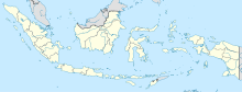
| Location | Werur, Tambrauw, West Papua, Indonesia | ||||||||||
| Elevation AMSL | 38 ft / 11 m | ||||||||||
| Coordinates | 00°25′10″S 132°11′29″E / 0.41944°S 132.19139°ECoordinates: 00°25′10″S 132°11′29″E / 0.41944°S 132.19139°E | ||||||||||
| Map | |||||||||||
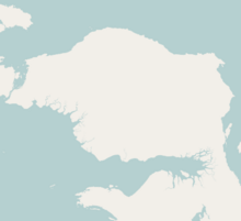 WRR Location in Bird's Head Peninsula | |||||||||||
| Runways | |||||||||||
| |||||||||||


Werur Airport (also known as Douglas Mac Arthur Airport) (IATA: WRR, ICAO: WAJY) is an airport in Tambrauw, West Papua, Indonesia. It replaced the smaller, former World War II airfield, Sansapor Airfield.[1][2]
Airlines and destinations[]
Passenger[]
| Airlines | Destinations |
|---|---|
| Susi Air | sorong Manokwari |
Background[]
The government said they will provide Rp30 billion, or about US$2.5 million, from the state budget for the construction of the airfield. In the meantime, Gabriel Asem, the head of Tambrauw district, remarked that the administration has budgeted Rp9 billion, or about US$752 thousand, for the construction of the airport and Rp3 billion, or about US$250 thousand, for acquiring the land for the airport. The airport needs a land area of 200 hectares, including for its runway, taxiway, and the apron. The area of the runway is 500 x 23 meters, while the runway strip is 520 x 60 meters. The Werur Airport will facilitate the locals and tourists to reach Raja Ampat and other locations in West Papua.[citation needed]
References[]
- ^ "About Werur Airport". Retrieved 7 August 2017.
- ^ "Airport base :about werur". Retrieved 7 August 2017.
External links[]
- Werur Airport Information
- Hari ini bandara werur beroperasi
- new-airport to be constructed in tambrauw west papua
This article about an Indonesian airport is a stub. You can help Wikipedia by . |
This West Papua location article is a stub. You can help Wikipedia by . |
- Airports in West Papua (province)
- Indonesian airport stubs
- Maluku Islands and New Guinea (Indonesia) geography stubs